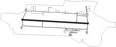
Rostock - Rostock-laage
Airport details
| Country | Germany |
| State | Mecklenburg-Vorpommern |
| Region | ED |
| Airspace | Bremen Ctr |
| Municipality | Laage |
| Elevation | 138ft (42m) |
| Timezone | GMT +1 |
| Coordinates | 53.91491, 12.29154 |
| Magnetic var | |
| Type | land |
| Available since | X-Plane v10.40 |
| ICAO code | ETNL |
| IATA code | RLG |
| FAA code | n/a |
Communication
| Rostock-Laage ATIS | 134.605 |
| Rostock-Laage APRON CIV | 121.955 |
| Rostock-Laage Tower | 118.430 |
| Rostock-Laage Tower | 122.100 |
| Rostock-Laage Laage Radar | 133.105 |
| Rostock-Laage Laage Radar | 123.300 |
| Rostock-Laage Bremen Radar | 124.175 |
Approach frequencies
| ILS-cat-I | RW09 | 108.55 | 18.00mi |
| ILS-cat-I | RW27 | 108.3 | 18.00mi |
| 3° GS | RW09 | 108.55 | 18.00mi |
| 3° GS | RW27 | 108.3 | 18.00mi |
Nearby Points of Interest:
Villa Korff
-Gutshaus Dolgen
-Church in Recknitz
-Gut Diekhof
-Burgwall Wardow
-Herrenhaus Schwiessel
-Schloss Prebberede
-Jüdischer Friedhof (Schwaan)
-Church in Warnkenhagen
-Postamt Güstrow
-Gleviner Straße 10
-Category:Haus der Kirche (Güstrow)
-Dorfkirche Parum
-Burgwall Reddershof
-Herrenhaus Tellow
-Burgwall Tessin
-Church in Buchholz
-Burgwall Neu Nieköhr
-Dorfkirche Badendiek
-Town hall in Bützow
-Kerkhoffhaus
-Rostock town hall
-Zeecksche Villa
-Kröpeliner Straße
-Katharinenkloster
Nearby beacons
| code | identifier | dist | bearing | frequency |
|---|---|---|---|---|
| LAG | LAAGE TACAN | 0.3 | 314° | 108.25 |
| PI | SCHWERIN-PARCHIM NDB | 30.4 | 220° | 333 |
| PMD | DME | 34.5 | 226° | 117.50 |
| PAH | SCHWERIN-PARCHIM NDB | 38.3 | 230° | 315 |
| BKD | BRUENKENDORF VOR/DME | 59.2 | 220° | 117.70 |
Departure and arrival routes
| Transition altitude | 5000ft |
| SID end points | distance | outbound heading | |
|---|---|---|---|
| RW09 | |||
| NL36 | 20mi | 108° | |
| NL34 | 20mi | 249° | |
| NL32 | 22mi | 358° | |
| RW27 | |||
| NL16 | 20mi | 108° | |
| NL14 | 20mi | 249° | |
| NL12 | 22mi | 358° | |
Instrument approach procedures
| runway | airway (heading) | route (dist, bearing) |
|---|---|---|
| RW09 | BADOB (119°) | BADOB 5000ft NL041 (10mi, 176°) 3500ft |
| RW09 | BITSO (77°) | BITSO 4000ft NL041 (7mi, 28°) 3500ft |
| RW09 | GASBO (178°) | GASBO BADOB (16mi, 242°) 5000ft NL041 (10mi, 176°) 3500ft |
| RW09 | LEGSA (288°) | LEGSA BITSO (32mi, 275°) 4000ft NL041 (7mi, 28°) 3500ft |
| RW09 | TAGOB (69°) | TAGOB BITSO (6mi, 36°) 4000ft NL041 (7mi, 28°) 3500ft |
| RNAV | NL041 3500ft ROLAX (5mi, 94°) 2000ft ETNL (7mi, 95°) 181ft NL042 (2mi, 93°) NL043 (6mi, 23°) BADOB (17mi, 283°) 5000ft | |
| RW27 | BADSU (259°) | BADSU 5000ft NL021 (6mi, 209°) 3500ft |
| RW27 | GASBO (178°) | GASBO BADSU (22mi, 127°) 5000ft NL021 (6mi, 209°) 3500ft |
| RW27 | LEGSA (288°) | LEGSA TETKO (7mi, 282°) 4000ft NL021 (6mi, 357°) 3500ft |
| RW27 | TAGOB (69°) | TAGOB TETKO (28mi, 86°) 4000ft NL021 (6mi, 357°) 3500ft |
| RW27 | TETKO (291°) | TETKO 4000ft NL021 (6mi, 357°) 3500ft |
| RNAV | NL021 3500ft ESERO (5mi, 275°) 2000ft ETNL (6mi, 274°) 155ft NL022 (3mi, 276°) NL023 (6mi, 6°) NL024 (11mi, 90°) BADSU (5mi, 104°) 5000ft |
Disclaimer
The information on this website is not for real aviation. Use this data with the X-Plane flight simulator only! Data taken with kind consent from X-Plane 12 source code and data files. Content is subject to change without notice.