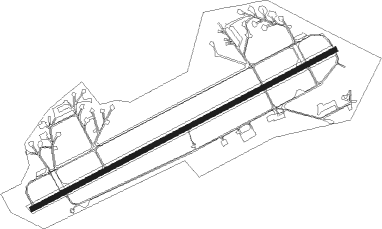
Noervenich Ab
Airport details
| Country | Germany |
| State | North Rhine-Westphalia |
| Region | ED |
| Airspace | Langen Ctr |
| Municipality | Nörvenich |
| Elevation | 386ft (118m) |
| Timezone | GMT +1 |
| Coordinates | 50.83114, 6.65823 |
| Magnetic var | |
| Type | land |
| Available since | X-Plane v10.40 |
| ICAO code | ETNN |
| IATA code | n/a |
| FAA code | n/a |
Communication
| Noervenich AB Noervenich tower | 136.200 |
| Noervenich AB Noervenich tower | 122.100 |
| Noervenich AB Noervenich approach | 123.300 |
| Noervenich AB Noervenich approach | 129.850 |
| Noervenich AB Langen control | 128.500 |
| Noervenich AB Langen control | 126.325 |
Approach frequencies
| ILS-cat-I | RW25 | 109.7 | 18.00mi |
| 3° GS | RW25 | 109.7 | 18.00mi |
Nearby Points of Interest:
Rathaus
-Burggraben und Park von Schloss Nörvenich
-Haus Bahnhofstraße 11 (Nörvenich)
-Harff’sche Burg
-Fußfall (Hochkirchen)
-Fachwerkhaus Am Bräucher 2
-Fachwerkhof Kompstraße 24
-Wasserpumpe Pingsheim
-St. Margaretha
-Wegekreuz Pützstraße
-Wasserpumpe Weststraße
-Annakapelle
-Ahrburg
-Fachwerkhaus Kurfürstenstraße 13
-Motte Irresheim
-bakehouse (Irresheim)
-Wegekreuz Gladbacher Straße
-Stacherburg
-Wasserpumpe Heribertstraße
-Bauernhof Heribertstraße 32
-Bauernhof Heribertstraße 34
-Bauernhof Heribertstraße 2
-Wasserpumpe Buntwolfstraße
-Wegekreuz Gut Hommelsheim
-Bunker Isweiler
Nearby beacons
| code | identifier | dist | bearing | frequency |
|---|---|---|---|---|
| WNN | DME | 0.5 | 69° | 109.85 |
| NVO | NOERVENICH VORTAC | 0.9 | 249° | 116.20 |
| LJ | COLOGNE-BONN NDB | 16.3 | 77° | 365 |
| KBO | COLOGNE-BONN VOR/DME | 18.5 | 86° | 112.15 |
| LV | COLOGNE-BONN NDB | 22.1 | 93° | 327 |
| LW | COLOGNE-BONN NDB | 22.8 | 84° | 300 |
| DY | DUESSELDORF NDB | 24.2 | 359° | 284 |
| GIX | GEILENKIRCHEN TACAN | 24.5 | 282° | 108.10 |
| MHD | DME | 25 | 338° | 112.50 |
| MHV | MOENCHENGLADBACH VOR | 25.2 | 338° | 109.80 |
| WYP | WIPPER VOR | 26.9 | 71° | 109.60 |
| DUS | DUESSELDORF VOR/DME | 27.3 | 12° | 115.15 |
| MAS | MAASTRICHT VOR/DME | 27.7 | 281° | 108.60 |
| NW | MAASTRICHT NDB | 31.6 | 284° | 373 |
| LI | DUESSELDORF NDB | 32.2 | 24° | 417 |
| LMA | LIMA NDB | 33.9 | 334° | 311 |
| SLV | SPA NDB | 35.4 | 245° | 386 |
| BAM | BARMEN VOR/DME | 35.6 | 46° | 114 |
| COL | COLA VOR/DME | 35.6 | 93° | 108.80 |
| LNO | OLNO VOR/DME | 38.9 | 255° | 112.80 |
| BUE | BUECHEL TACAN | 42.2 | 148° | 117.10 |
| BOT | BOTTROP NDB | 47.3 | 26° | 406 |
| LAA | NIEDERRHEIN NDB | 49.7 | 328° | 352 |
| NID | DME | 50 | 326° | 115.50 |
| SPA | SPANGDAHLEM TACAN | 51.2 | 177° | 109.50 |
| DOR | WICKEDE (DORTMUND) VOR/DME | 55.4 | 54° | 108.65 |
| DWI | DORTMUND-WICKEDE NDB | 55.6 | 55° | 357 |
| HAN | HAHN NDB | 57.2 | 144° | 376 |
| FHH | DME | 58.1 | 146° | 117.35 |
| VKL | VOLKEL TACAN | 61 | 311° | 108.30 |
| DIK | DIEKIRCH NDB | 61.6 | 209° | 307 |
Disclaimer
The information on this website is not for real aviation. Use this data with the X-Plane flight simulator only! Data taken with kind consent from X-Plane 12 source code and data files. Content is subject to change without notice.