Jagel - Schleswig Jagel Ab
Airport details
| Country | Germany |
| State | Schleswig-Holstein |
| Region | ED |
| Airspace | Bremen Ctr |
| Municipality | Jagel |
| Elevation | 68ft (21m) |
| Timezone | GMT +1 |
| Coordinates | 54.45935, 9.51636 |
| Magnetic var | |
| Type | land |
| Available since | X-Plane v10.40 |
| ICAO code | ETNS |
| IATA code | WBG |
| FAA code | n/a |
Communication
| Schleswig Jagel AB BREMEN INFO | 125.100 |
| Schleswig Jagel AB Schleswig Tower | 125.100 |
| Schleswig Jagel AB RADAR | 123.300 |
| Schleswig Jagel AB RADAR | 135.150 |
Nearby Points of Interest:
Skarthi Stone
-Archaeological Border complex of Hedeby and the Danevirke
-Hedeby
-Danmarks runeindskrifter 2
-Schleswig-Holstein Supreme Court of Justice
-St.-Andreas-Kirche
-DR 4
-Heespenhof (Amtsgericht Schleswig)
-Schleswig stone
-Gut Falkenberg
-Feldwebel-Schmid-Kaserne
-Altes Seminar Eckernförde
-Amtsgericht Eckernförde
-Café Heldt
-Villa Kruckau
-Altes Rathaus
-Rundsilo
-Kontorhaus (Eckernförde)
-Christianspflegehaus
-Schuch-Speicher
-Alte Fischräucherei Eckernförde
-Süderschanzen-Denkmal
-Kaiserhof
-Alte Lotsenstation Nübbel
-Landschaftspark Hohenstein
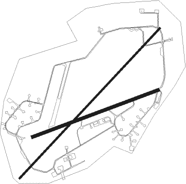
Runway info
Runway 05 / 23  | ||
| length | 2991m (9813ft) | |
| bearing | 62° / 242° | |
| width | 30m (98ft) | |
| surface | asphalt | |
| displ threshold | 267m (876ft) / 297m (974ft) | |
| Runway 07 / 25 | ||
| length | 1946m (6385ft) | |
| bearing | 81° / 261° | |
| width | 45m (148ft) | |
| surface | asphalt | |
| blast zone | 182m (597ft) / 79m (259ft) | |
Nearby beacons
| code | identifier | dist | bearing | frequency |
|---|---|---|---|---|
| SWG | SCHLESWIG TACAN | 0.2 | 3° | 111.80 |
| HNT | HOHN TACAN | 8.9 | 171° | 115.30 |
| HN | HOHN NDB | 9.6 | 131° | 344 |
| KIL | KIEL-HOLTENAU NDB | 21.6 | 98° | 353 |
| KHD | (HOLTENAU) DME-ILS | 22.5 | 97° | 109.50 |
| ALS | ALSIE VOR | 31.4 | 47° | 114.70 |
| VO | VOJENS/SKRYDSTRUP NDB | 46.7 | 342° | 321 |
| SKR | VOJENS/SKRYDSTRUP VORTAC | 47.3 | 339° | 110.40 |
| NDO | NORDHOLZ NDB | 47.5 | 226° | 372 |
| NDO | NORDHOLZ TACAN | 51.3 | 231° | 117.10 |
| ALF | DME | 52.2 | 150° | 115.80 |
| HAM | HAMBURG VORTAC | 52.4 | 138° | 113.10 |
| VAM | DME | 59.1 | 350° | 110.05 |
| KD | KOLDING NDB | 59.4 | 350° | 357 |
Disclaimer
The information on this website is not for real aviation. Use this data with the X-Plane flight simulator only! Data taken with kind consent from X-Plane 12 source code and data files. Content is subject to change without notice.