Wunstorf Ab
Airport details
| Country | Germany |
| State | Lower Saxony |
| Region | ED |
| Airspace | Bremen Ctr |
| Municipality | Wunstorf |
| Elevation | 187ft (57m) |
| Timezone | GMT +1 |
| Coordinates | 52.45733, 9.42716 |
| Magnetic var | |
| Type | land |
| Available since | X-Plane v10.40 |
| ICAO code | ETNW |
| IATA code | n/a |
| FAA code | n/a |
Communication
| Wunstorf AB Wunstorf tower | 122.100 |
Approach frequencies
| ILS-cat-I | RW08 | 110.55 | 18.00mi |
| ILS-cat-I | RW26 | 109.7 | 18.00mi |
| 3° GS | RW08 | 110.55 | 18.00mi |
| 3° GS | RW26 | 109.7 | 18.00mi |
Nearby Points of Interest:
Gut Liethe
-Schloss Blumenau
-Amtsgericht Neustadt am Rübenberge
-Schloss Bokeloh
-Protestant Church Dedensen
-Kirche Osterwald
-Altgarbsen Church
-Rathaus Sachsenhagen
-Schule
-Rittergut Stemmen
-Corvinuskirche
-Brennereiweg 1
-Goldener Winkel 1
-Schwedenstein
-Kriegerdenkmal
-Anna-Forcke-Stift
-Helstorfer Kirche
-Chapel Velber
-Kapelle Lutter
-Kapelle Langreder
-Ernst von Malortie grave
-Israelitische Gartenbauschule Ahlem
-Schulenburger Landstraße 167-225
-Ringwall auf dem Gehrdener Berg
-Alte Herrenhäuser Straße 7
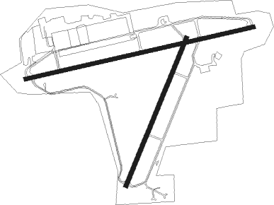
Runway info
Runway 08 / 26  | ||
| length | 2494m (8182ft) | |
| bearing | 85° / 265° | |
| width | 45m (148ft) | |
| surface | concrete | |
| displ threshold | 250m (820ft) / 229m (751ft) | |
| Runway 03 / 21 | ||
| length | 1701m (5581ft) | |
| bearing | 40° / 220° | |
| width | 45m (148ft) | |
| surface | asphalt | |
Nearby beacons
| code | identifier | dist | bearing | frequency |
|---|---|---|---|---|
| WUN | WUNSTORF TACAN | 0.1 | 138° | 114.85 |
| HW | HANNOVER NDB | 4.4 | 85° | 358 |
| HBD | DME | 8.4 | 91° | 116.90 |
| HAD | DME | 9.8 | 88° | 113.95 |
| NIE | NIENBURG VOR | 10.3 | 342° | 116.50 |
| HA | HANNOVER NDB | 13.8 | 89° | 320 |
| BYC | BUECKEBURG NDB | 15.8 | 244° | 368 |
| DLE | LEINE VOR/DME | 20.8 | 114° | 115.20 |
| SAS | SARSTEDT VOR/DME | 20.8 | 114° | 114.45 |
| CEL | CELLE NDB | 23.3 | 78° | 311 |
| DP | DIEPHOLZ NDB | 36.4 | 278° | 325 |
| FSB | FASSBERG NDB | 39 | 59° | 284 |
| HIG | BREMEN NDB | 40.2 | 319° | 318 |
| BND | DME | 42.3 | 312° | 113.65 |
| BMN | BREMEN VOR/DME | 42.8 | 311° | 117.45 |
| WSN | WESER NDB | 57 | 328° | 378 |
| PAD | PADERBORN-LIPPSTADT NDB | 57.9 | 223° | 354 |
| WRB | WARBURG VOR/DME | 58.3 | 198° | 113.70 |
| PAD | DME-ILS | 58.9 | 224° | 108.50 |
Departure and arrival routes
| Transition altitude | 5000ft |
| SID end points | distance | outbound heading | |
|---|---|---|---|
| RW08 | |||
| CEL1A | 23mi | 78° | |
| SAS1A | 21mi | 114° | |
| ROBE1A | 15mi | 215° | |
| VAXE1A | 13mi | 260° | |
| NIE1A | 10mi | 342° | |
| RW26 | |||
| CEL1B | 23mi | 78° | |
| ROBE1B | 15mi | 215° | |
| VAXE1B | 13mi | 260° | |
| NIE1B | 10mi | 342° | |
Instrument approach procedures
| runway | airway (heading) | route (dist, bearing) |
|---|---|---|
| RW08 | NIE (162°) | NIE 3000ft NW500 (8mi, 231°) NW501 (5mi, 265°) NW502 (5mi, 265°) NW503 (5mi, 265°) 3000ft NW504 (5mi, 166°) 3000ft NW505 (5mi, 85°) 3000ft NW506 (5mi, 85°) 2000ft |
| RW08 | ROBEG (35°) | ROBEG 4000ft NW520 (8mi, 314°) NW521 (5mi, 265°) NW522 (5mi, 265°) 4000ft NW504 (5mi, 346°) 3000ft NW505 (5mi, 85°) 3000ft NW506 (5mi, 85°) 2000ft |
| RNAV | NW506 2000ft NW507 (5mi, 85°) 2000ft ETNW (6mi, 85°) 221ft (3186mi, 190°) 700ft NIE (3196mi, 10°) 3000ft | |
| RW26 | NIE (162°) | NIE 3000ft NW400 (8mi, 111°) NW401 (5mi, 85°) NW402 (5mi, 85°) NW403 (5mi, 85°) NW404 (5mi, 166°) 3000ft NW405 (5mi, 265°) 3000ft NW406 (5mi, 265°) 2000ft |
| RNAV | NW406 2000ft NW407 (5mi, 265°) 2000ft ETNW (6mi, 265°) 224ft NW410 (5mi, 260°) NIE (12mi, 21°) 3000ft |
Disclaimer
The information on this website is not for real aviation. Use this data with the X-Plane flight simulator only! Data taken with kind consent from X-Plane 12 source code and data files. Content is subject to change without notice.