Erding Afb
Airport details
| Country | Germany |
| State | Bavaria |
| Region | |
| Airspace | Munich Ctr |
| Municipality | Erding |
| Elevation | 1515ft (462m) |
| Timezone | GMT +1 |
| Coordinates | 48.31956, 11.92828 |
| Magnetic var | |
| Type | land |
| Available since | X-Plane v10.40 |
| ICAO code | ETSE |
| IATA code | n/a |
| FAA code | n/a |
Communication
Nearby Points of Interest:
Wohnstallhaus (Grucking)
-Hofkapelle
-Schloss Grünbach
-Hofkapelle St. Florian
-Burg Wartenberg
-Pfarrhaus Unterhofkirchen
-Schloss Ottenhofen
-Birkeneck
-Zum Alten Wirt
-Burg Kopfsburg
-St. Stephanus
-Filialkirche Pauli Bekehrung (Kleinviecht)
-Pfarrhaus
-Eckherhaus
-Abensbergerdenkmal
-Heiliggeistspital (Freising)
-Wasserturm in der Art eines mittelalterlichen Stadtturms
-Untere Hauptstraße 7 (Freising)
-Fürstbischöfliches Lyceum
-Mariensäule
-Rathaus
-Ziererhaus
-Rathaus Moosburg an der Isar
-Jägersteig 5
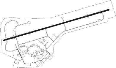
Runway info
| Runway 08 / 26 | ||
| length | 2946m (9665ft) | |
| bearing | 82° / 262° | |
| width | 30m (98ft) | |
| surface | asphalt | |
| displ threshold | 284m (932ft) / 147m (482ft) | |
| blast zone | 0m (0ft) / 84m (276ft) | |
Nearby beacons
| code | identifier | dist | bearing | frequency |
|---|---|---|---|---|
| MSW | MUNICH NDB | 2.2 | 323° | 400 |
| MNW | MUNICH NDB | 3.3 | 346° | 338 |
| DMN | DME | 6 | 289° | 116 |
| DMS | DME | 6.1 | 278° | 115 |
| OTT | OTTERSBERG VOR/DME | 9.4 | 219° | 112.30 |
| MNE | MUNICH NDB | 10.3 | 278° | 369 |
| MSE | MUNICH NDB | 11 | 273° | 358 |
| MIQ | MIKE NDB | 20 | 307° | 426 |
| MAH | MAISACH VOR/DME | 24.8 | 265° | 115.20 |
| IGL | INGOLSTADT NDB | 27.5 | 326° | 345 |
| IGL | INGOLSTADT TACAN | 27.8 | 318° | 111.40 |
| OBI | OBERPFAFFENHOFEN NDB | 29.4 | 250° | 429 |
| WLD | WALDA VOR/DME | 35.4 | 288° | 112.80 |
| NEU | NEUBURG TACAN | 37 | 299° | 108.90 |
| AUG | DME | 40 | 276° | 115.90 |
| AGB | AUGSBURG NDB | 40.1 | 276° | 318 |
| SBG | SALZBURG VOR/DME | 43 | 108° | 113.80 |
| SBG | SALZBURG NDB | 44.1 | 110° | 382 |
| RDG | RODING VOR/DME | 49.3 | 40° | 114.70 |
| RTT | RATTENBERG NDB | 53.3 | 179° | 303 |
| HFX | HOHENFELS NDB | 54 | 356° | 286 |
Disclaimer
The information on this website is not for real aviation. Use this data with the X-Plane flight simulator only! Data taken with kind consent from X-Plane 12 source code and data files. Content is subject to change without notice.