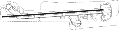
Neuburg (donau) - Neuburg-zell Ab
Airport details
| Country | Germany |
| State | Bavaria |
| Region | ED |
| Airspace | Munich Ctr |
| Municipality | Neuburg an der Donau |
| Elevation | 1246ft (380m) |
| Timezone | GMT +1 |
| Coordinates | 48.70962, 11.20475 |
| Magnetic var | |
| Type | land |
| Available since | X-Plane v10.40 |
| ICAO code | ETSN |
| IATA code | n/a |
| FAA code | n/a |
Communication
| Neuburg-Zell AB Neuburg Tower | 122.100 |
Approach frequencies
| ILS-cat-I | RW27 | 109.35 | 18.00mi |
| 3° GS | RW27 | 109.35 | 18.00mi |
Nearby Points of Interest:
Evangelisch-reformierte Kirche (Marienheim)
-Rathaus (Neuburg an der Donau)
-Staatliche Bibliothek Neuburg an der Donau
-Weveldhaus (Neuburg an der Donau)
-St. Mauritius
-Mariä Geburt
-Burg Hütting
-Villa Rustica
-Filialkirche zur Unbefleckten Empfängnis Mariens
-Abschnittsbefestigung Schorn
-Schloßberg in Wellheim mit Felsentor
-Burg Konstein
-Friedhofskapelle
-Kriegerdenkmal Pöttmes
-Westlicher Torturm (Pöttmes)
-Deutsches Medizinhistorisches Museum
-Volksschule Auf der Schanz
-Bei der Schleifmühle 26
-Collegium Georgianum
-Tillyhaus
-Landschaftshaus
-Stadtmauer
-Altes Rathaus
-Ickstatthaus
-Mietshaus
Nearby beacons
| code | identifier | dist | bearing | frequency |
|---|---|---|---|---|
| NEU | NEUBURG TACAN | 0.3 | 65° | 108.90 |
| WLD | WALDA VOR/DME | 8.3 | 210° | 112.80 |
| IGL | INGOLSTADT TACAN | 14.4 | 89° | 111.40 |
| IGL | INGOLSTADT NDB | 17.5 | 86° | 345 |
| MIQ | MIKE NDB | 17.6 | 110° | 426 |
| AUG | DME | 20.1 | 223° | 115.90 |
| AGB | AUGSBURG NDB | 20.2 | 224° | 318 |
| MAH | MAISACH VOR/DME | 27.1 | 166° | 115.20 |
| MNE | MUNICH NDB | 28.3 | 127° | 369 |
| MSE | MUNICH NDB | 28.7 | 130° | 358 |
| DMN | DME | 31.1 | 120° | 116 |
| DMS | DME | 31.7 | 123° | 115 |
| LCH | LECHFELD TACAN | 34 | 214° | 108.80 |
| MNW | MUNICH NDB | 34.6 | 115° | 338 |
| MSW | MUNICH NDB | 35.1 | 117° | 400 |
| OBI | OBERPFAFFENHOFEN NDB | 37.9 | 173° | 429 |
| HFX | HOHENFELS NDB | 39.9 | 52° | 286 |
| OTT | OTTERSBERG VOR/DME | 40 | 131° | 112.30 |
| ANS | ANSBACH NDB | 42.4 | 316° | 452 |
| DKB | DINKELSBUEHL VORTAC | 46.1 | 294° | 117.80 |
| RTB | ROETHENBACH NDB | 46.4 | 4° | 415 |
| NGD | DME | 47.7 | 351° | 113.10 |
| NUB | NUERNBERG VOR/DME | 48.1 | 348° | 115.75 |
| ILM | ILLESHEIM NDB | 55.9 | 313° | 488 |
| ERL | ERLANGEN VOR/DME | 56.8 | 357° | 114.90 |
| ALG | ALLGAEU (MEMMINGEN) NDB | 56.9 | 233° | 341 |
| ALD | (MEMMINGEN/ALLGAU) DME | 58.1 | 233° | 117.20 |
| GRF | GRAFENWOHR TACAN | 65.6 | 37° | 111.80 |
| GRW | GRAFENWOHR NDB | 65.8 | 37° | 405 |
| KPT | KEMPTEN VOR/DME | 67.2 | 222° | 108.40 |
Disclaimer
The information on this website is not for real aviation. Use this data with the X-Plane flight simulator only! Data taken with kind consent from X-Plane 12 source code and data files. Content is subject to change without notice.