Tofield
Airport details
| Country | Canada |
| State | Alberta |
| Region | |
| Airspace | Edmonton Ctr |
| Municipality | Town of Tofield |
| Elevation | 2311ft (704m) |
| Timezone | GMT -7 |
| Coordinates | 53.37310, -112.70216 |
| Magnetic var | |
| Type | land |
| Available since | X-Plane v10.40 |
| ICAO code | EV7 |
| IATA code | n/a |
| FAA code | n/a |
Communication
| Tofield CTAF | 123.200 |
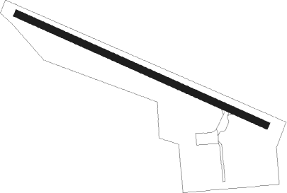
Runway info
| Runway 10 / 28 | ||
| length | 914m (2999ft) | |
| bearing | 108° / 288° | |
| width | 23m (75ft) | |
| surface | asphalt | |
Nearby beacons
| code | identifier | dist | bearing | frequency |
|---|---|---|---|---|
| 2K | CAMROSE NDB | 20.8 | 198° | 405 |
| X5 | VEGREVILLE NDB | 25.4 | 78° | 225 |
| ZAB | LEDUC (EDMONTON) NDB | 29.3 | 261° | 215 |
| EB | NAMAO (EDMONTON) NDB | 32.3 | 291° | 256 |
| ZET | DEVON (EDMONTON) NDB | 34.7 | 269° | 292 |
| ZZD | CALMAR (EDMONTON) NDB | 35 | 263° | 308 |
| D3 | PONOKA INDUS NDB | 52.7 | 233° | 363 |
Disclaimer
The information on this website is not for real aviation. Use this data with the X-Plane flight simulator only! Data taken with kind consent from X-Plane 12 source code and data files. Content is subject to change without notice.