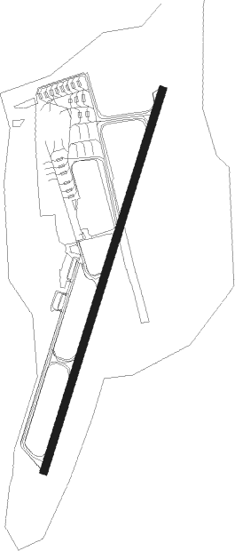
Vilnius - Vilnius Intl.
Airport details
| Country | Lithuania |
| State | Vilnius County |
| Region | EY |
| Airspace | Vilnius Ctr |
| Municipality | Vilnius |
| Elevation | 597ft (182m) |
| Timezone | GMT +2 |
| Coordinates | 54.63694, 25.28778 |
| Magnetic var | |
| Type | land |
| Available since | X-Plane v10.40 |
| ICAO code | EYVI |
| IATA code | VNO |
| FAA code | n/a |
Communication
| Vilnius Intl. ATIS | 125.800 |
| Vilnius Intl. Vilnius Tower | 118.200 |
| Vilnius Intl. Vilnius Approach | 120.700 |
Approach frequencies
| ILS-cat-II | RW01 | 110.5 | 18.00mi |
| ILS-cat-I | RW19 | 109.1 | 18.00mi |
| 3° GS | RW01 | 110.5 | 18.00mi |
| 3° GS | RW19 | 109.1 | 18.00mi |
Nearby Points of Interest:
Kernavė
-Church of the Visitation of the Blessed Virgin Mary in Hudahaj
-Holy Trinity church in Hiermaniški
-Church of Saint John the Baptist in Bieniakoni
Nearby beacons
| code | identifier | dist | bearing | frequency |
|---|---|---|---|---|
| VNO | VILNIUS VOR/DME | 0.2 | 99° | 113.80 |
| AVN | VILNIUS NDB | 2.8 | 35° | 385 |
| PBZ | DME | 17.5 | 351° | 117.25 |
| SML | DME | 20.8 | 274° | 112.50 |
| VLK | DME | 24 | 239° | 116.70 |
Departure and arrival routes
| Transition altitude | 5000ft |
| SID end points | distance | outbound heading | |
|---|---|---|---|
| RW01 | |||
| UTEN1A | 50mi | 11° | |
| LAFA1A | 21mi | 68° | |
| DUKA1A | 15mi | 117° | |
| SOGB1A | 26mi | 192° | |
| UPAS1A | 38mi | 256° | |
| NEDA1A | 41mi | 287° | |
| IKAM1G, IKAM1A | 48mi | 317° | |
| MURU1G, MURU1A | 52mi | 340° | |
| TAGO1A | 50mi | 355° | |
| RW19 | |||
| UTEN1B | 50mi | 11° | |
| LAFA1B | 21mi | 68° | |
| DUKA1B | 15mi | 117° | |
| SOGB1B | 26mi | 192° | |
| UPAS1B | 38mi | 256° | |
| NEDA1B | 41mi | 287° | |
| IKAM1B | 48mi | 317° | |
| MURU1B | 52mi | 340° | |
| TAGO1B | 50mi | 355° | |
| STAR starting points | distance | inbound heading | |
|---|---|---|---|
| RW01 | |||
| SOGB2A | 25.6 | 12° | |
| DIMT2A | 39.4 | 70° | |
| NEDA2A | 40.7 | 107° | |
| LAFA2A | 20.6 | 248° | |
| DUKA2A | 15.1 | 297° | |
| RW19 | |||
| NEDA2B | 40.7 | 107° | |
| TAGO2B | 50.1 | 175° | |
| LAFA2B | 20.6 | 248° | |
| DUKA2B | 15.1 | 297° | |
Instrument approach procedures
| runway | airway (heading) | route (dist, bearing) |
|---|---|---|
| RW01 | BILDI (82°) | BILDI 5000ft NESER (7mi, 135°) VI312 (4mi, 103°) 3000ft |
| RW01 | INSOL (338°) | INSOL 5000ft VI313 (4mi, 227°) VI312 (5mi, 283°) 3000ft |
| RW01 | NOLNA (35°) | NOLNA 4000ft VI312 (6mi, 35°) 3000ft |
| RNAV | VI312 3000ft VI311 (4mi, 35°) 2700ft EYVI (7mi, 35°) 645ft VI314 (8mi, 35°) 2700ft VI407 (10mi, 86°) 5000ft VI408 (12mi, 190°) INSOL (11mi, 251°) 5000ft INSOL (turn) 5000ft | |
| RW19 | EKSAM (234°) | EKSAM 5000ft VI412 (6mi, 259°) 3000ft |
| RW19 | GEKBI (206°) | GEKBI 4000ft VI412 (4mi, 179°) 3000ft |
| RW19 | KOTOV (127°) | KOTOV 5000ft VI414 (8mi, 83°) VI412 (5mi, 103°) 3000ft |
| RNAV | VI412 3000ft VI411 (4mi, 215°) 2700ft EYVI (7mi, 215°) 700ft VI415 (8mi, 215°) 2700ft VI413 (10mi, 96°) 5000ft VI407 (19mi, 31°) EKSAM (5mi, 305°) 5000ft EKSAM (turn) 5000ft |
Holding patterns
| STAR name | hold at | type | turn | heading* | altitude | leg | speed limit |
|---|---|---|---|---|---|---|---|
| DIMT2A | NOLNA | VHF | right | 193 (13)° | > 4000ft | 1.0min timed | 230 |
| DUKA2A | INSOL | VHF | left | 24 (204)° | > 5000ft | 1.0min timed | 230 |
| DUKA2B | EKSAM | VHF | right | 64 (244)° | > 5000ft | 1.0min timed | 230 |
| IKAM2A | BILDI | VHF | left | 321 (141)° | > 5000ft | 1.0min timed | 230 |
| IKAM2A | OBANO | VHF | left | 4 (184)° | > 5000ft | 1.0min timed | ICAO rules |
| IKAM2B | KOTOV | VHF | right | 249 (69)° | > 5000ft | 1.0min timed | 230 |
| IRKA2A | BILDI | VHF | left | 321 (141)° | > 5000ft | 1.0min timed | 230 |
| IRKA2B | KOTOV | VHF | right | 249 (69)° | > 5000ft | 1.0min timed | 230 |
| LAFA2A | INSOL | VHF | left | 24 (204)° | > 5000ft | 1.0min timed | 230 |
| LAFA2B | EKSAM | VHF | right | 64 (244)° | > 5000ft | 1.0min timed | 230 |
| MURU2A | BILDI | VHF | left | 321 (141)° | > 5000ft | 1.0min timed | 230 |
| MURU2A | OBANO | VHF | left | 4 (184)° | > 5000ft | 1.0min timed | ICAO rules |
| MURU2B | GEKBI | VHF | right | 351 (171)° | > 4000ft | 1.0min timed | 230 |
| NEDA2A | BILDI | VHF | left | 321 (141)° | > 5000ft | 1.0min timed | 230 |
| NEDA2B | KOTOV | VHF | right | 249 (69)° | > 5000ft | 1.0min timed | 230 |
| SOGB2A | NOLNA | VHF | right | 193 (13)° | > 4000ft | 1.0min timed | 230 |
| TAGO2A | BILDI | VHF | left | 321 (141)° | > 5000ft | 1.0min timed | 230 |
| TAGO2A | OBANO | VHF | left | 4 (184)° | > 5000ft | 1.0min timed | ICAO rules |
| TAGO2B | GEKBI | VHF | right | 351 (171)° | > 4000ft | 1.0min timed | 230 |
| UTEN2A | BILDI | VHF | left | 321 (141)° | > 5000ft | 1.0min timed | 230 |
| UTEN2A | OBANO | VHF | left | 4 (184)° | > 5000ft | 1.0min timed | ICAO rules |
| UTEN2B | GEKBI | VHF | right | 351 (171)° | > 4000ft | 1.0min timed | 230 |
| *) magnetic outbound (inbound) holding course | |||||||
Disclaimer
The information on this website is not for real aviation. Use this data with the X-Plane flight simulator only! Data taken with kind consent from X-Plane 12 source code and data files. Content is subject to change without notice.