Edmonton - Edmonton Cooking Lake
Airport details
| Country | Canada |
| State | Alberta |
| Region | CY |
| Airspace | Edmonton Ctr |
| Municipality | Strathcona County |
| Elevation | 2431ft (741m) |
| Timezone | GMT -7 |
| Coordinates | 53.42753, -113.11557 |
| Magnetic var | |
| Type | land |
| Available since | X-Plane v10.40 |
| ICAO code | EZ3 |
| IATA code | n/a |
| FAA code | n/a |
Communication
Nearby Points of Interest:
Fort Edmonton
-Alberta Legislature Building
-Molson Brewery
-Queen Elizabeth II Planetarium
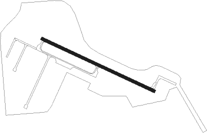
Runway info
| Runway 10 / 28 | ||
| length | 901m (2956ft) | |
| bearing | 109° / 289° | |
| width | 23m (75ft) | |
| surface | asphalt | |
Nearby beacons
| code | identifier | dist | bearing | frequency |
|---|---|---|---|---|
| ZAB | LEDUC (EDMONTON) NDB | 17.3 | 244° | 215 |
| EB | NAMAO (EDMONTON) NDB | 18.9 | 305° | 256 |
| ZET | DEVON (EDMONTON) NDB | 20.4 | 262° | 292 |
| ZZD | CALMAR (EDMONTON) NDB | 22.1 | 252° | 308 |
| 2K | CAMROSE NDB | 26.1 | 143° | 405 |
| YEG | EDMONTON VOR/DME | 30.6 | 252° | 117.60 |
| D3 | PONOKA INDUS NDB | 48 | 213° | 363 |
Disclaimer
The information on this website is not for real aviation. Use this data with the X-Plane flight simulator only! Data taken with kind consent from X-Plane 12 source code and data files. Content is subject to change without notice.