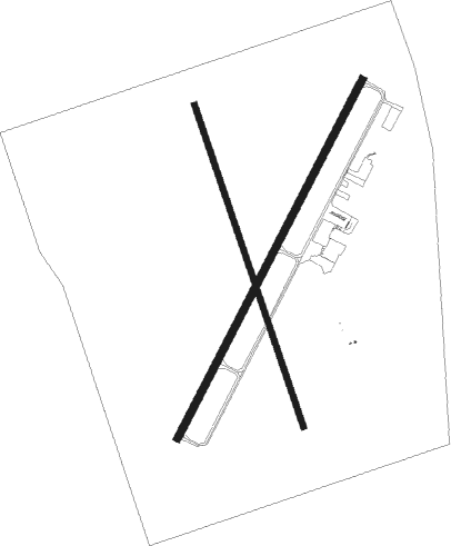
Vernon - Wilbarger County
Airport details
| Country | United States of America |
| State | Texas |
| Region | K4 |
| Airspace | Ft Worth Ctr |
| Municipality | Wilbarger County |
| Elevation | 1265ft (386m) |
| Timezone | GMT -6 |
| Coordinates | 34.22264, -99.28004 |
| Magnetic var | |
| Type | land |
| Available since | X-Plane v10.40 |
| ICAO code | F05 |
| IATA code | n/a |
| FAA code | F05 |
Communication
| Wilbarger County AWOS 3 | 118.525 |
| Wilbarger County CTAF/UNICOM | 122.800 |
| Wilbarger County ALTUS Approach/Departure | 125.100 |
Nearby Points of Interest:
Doan's Adobe House
-Tillman County Courthouse
-Jackson County Courthouse
-W.C. Baker House
Nearby beacons
| code | identifier | dist | bearing | frequency |
|---|---|---|---|---|
| LTS | ALTUS VORTAC | 26.4 | 1° | 109.80 |
| SPS | WICHITA FALLS VORTAC | 36.9 | 109° | 112.70 |
| HBR | HOBART VORTAC | 40.1 | 19° | 111.80 |
| SHP | SHEPPARD (WICHITA FALLS) TACAN | 41.9 | 107° | 110.80 |
| LAW | LAWTON VOR/DME | 46 | 72° | 109.40 |
| SKB | SCOTLAND (WICHITA FALLS) NDB | 47.4 | 119° | 344 |
Instrument approach procedures
| runway | airway (heading) | route (dist, bearing) |
|---|---|---|
| RW02 | CDS (98°) | CDS OPULY (43mi, 108°) 3400ft OXULY (5mi, 117°) 3300ft |
| RW02 | OXULY (38°) | OXULY 3300ft |
| RW02 | VASTY (317°) | VASTY HAZLE (9mi, 231°) 3400ft OXULY (5mi, 297°) 3300ft |
| RNAV | OXULY 3300ft ZUBDO (6mi, 37°) 3000ft WIBIS (3mi, 37°) 1880ft F05 (5679mi, 88°) 1304ft (6874mi, 251°) 1670ft OXULY (5873mi, 289°) 3300ft OXULY (turn) | |
| RW20 | ADOBE (147°) | ADOBE KEFZU (21mi, 125°) 3100ft EFAKU (5mi, 117°) 3100ft |
| RW20 | VASTY (317°) | VASTY BECAT (15mi, 27°) 3100ft EFAKU (5mi, 297°) 3100ft |
| RNAV | EFAKU 3100ft YEPUV (6mi, 217°) 3000ft VIDUY (4mi, 217°) 1700ft F05 (5677mi, 88°) 1295ft OXULY (5683mi, 268°) 3300ft OXULY (turn) |
Disclaimer
The information on this website is not for real aviation. Use this data with the X-Plane flight simulator only! Data taken with kind consent from X-Plane 12 source code and data files. Content is subject to change without notice.

