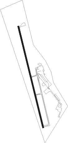
Tenaha - Center Muni
Airport details
| Country | United States of America |
| State | Texas |
| Region | K4 |
| Airspace | Ft Worth Ctr |
| Municipality | Shelby County |
| Elevation | 316ft (96m) |
| Timezone | GMT -6 |
| Coordinates | 31.83158, -94.15642 |
| Magnetic var | |
| Type | land |
| Available since | X-Plane v10.40 |
| ICAO code | F17 |
| IATA code | n/a |
| FAA code | n/a |
Communication
| Center Muni CTAF/UNICOM | 122.800 |
Nearby Points of Interest:
San Augustine County Courthouse and Jail
-Grand Cane United Methodist Church
-Keachi Baptist Church
-Liberty Lodge No. 123, F&AM
-Keachi Presbyterian Church
-Keachi United Methodist Church
-DeSoto Parish Courthouse
-Sterne-Hoya House Museum and Library
-Kansas City Southern Depot, Zwolle
-Woodmen of the World Building
-Gaines–Oliphint House
Nearby beacons
| code | identifier | dist | bearing | frequency |
|---|---|---|---|---|
| CZJ | AMASON (CENTER) NDB | 0.1 | 64° | 341 |
| RPF | CARTHAGE NDB | 22.1 | 338° | 332 |
| OC | NADOS (NACOGDOCHES) NDB | 35.5 | 238° | 253 |
| EMG | ELM GROVE VORTAC | 44.5 | 45° | 111.20 |
| GGG | GREGG CO. (LONGVIEW) VORTAC | 46.4 | 314° | 112.90 |
| BAD | BARKSDALE (BOSSIER CITY) TACAN | 47.3 | 36° | 115.80 |
| LFK | LUFKIN VORTAC | 49.3 | 220° | 112.10 |
| GG | VEELS (LONGVIEW) NDB | 49.6 | 314° | 410 |
| LF | FLUFY (LUFKIN) NDB | 50.2 | 227° | 350 |
| EIC | BELCHER (SHREVEPORT) VORTAC | 59.1 | 20° | 117.40 |
| FXU | POLK (FORT POLK) VOR | 64.6 | 128° | 108.40 |
| ABG | AMBASSADOR (BIG SANDY) NDB | 66.4 | 308° | 404 |
Instrument approach procedures
| runway | airway (heading) | route (dist, bearing) |
|---|---|---|
| RW17 | CARTH (176°) | CARTH DEBKY (6mi, 189°) 3000ft |
| RW17 | DEBKY (169°) | DEBKY 3000ft |
| RNAV | DEBKY 3000ft SIYGO (6mi, 169°) 2000ft SODVE (3mi, 169°) 900ft F17 (5915mi, 87°) 364ft (6888mi, 251°) 720ft DEBKY (5619mi, 289°) 3000ft DEBKY (turn) 3000ft | |
| RW35 | COVEX (260°) | COVEX TECRO (21mi, 229°) 3000ft FIJEC (5mi, 262°) 3000ft |
| RW35 | LFK (40°) | LFK HUPHA (38mi, 47°) 3000ft FIJEC (5mi, 82°) 3000ft |
| RNAV | FIJEC 3000ft AZGUF (6mi, 349°) 2000ft F17 (5923mi, 87°) 336ft (6888mi, 251°) 719ft WENDE (5617mi, 289°) CARTH (16mi, 357°) 3800ft CARTH (turn) |
Disclaimer
The information on this website is not for real aviation. Use this data with the X-Plane flight simulator only! Data taken with kind consent from X-Plane 12 source code and data files. Content is subject to change without notice.