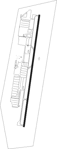
Murietta - French Valley
Airport details
| Country | United States of America |
| State | California |
| Region | K2 |
| Airspace | Los Angeles Ctr |
| Municipality | Riverside County |
| Elevation | 1350ft (411m) |
| Timezone | GMT -8 |
| Coordinates | 33.57418, -117.12847 |
| Magnetic var | |
| Type | land |
| Available since | X-Plane v10.40 |
| ICAO code | F70 |
| IATA code | n/a |
| FAA code | n/a |
Communication
| Murietta - French Valley AWOS 3 | 119.025 |
| Murietta - French Valley CTAF/UNICOM | 122.800 |
| Murietta - French Valley Clearance DEL | 133.500 |
| Murietta - French Valley MARCH Approach/Departure | 134.000 |
| Murietta - French Valley MARCH Approach/Departure | 133.500 |
Nearby Points of Interest:
Perris Depot
-Greystone Villa-Cabin 18
-Las Flores Estancia
-Gilman Ranch
-Mount Ecclesia
-Victoria Avenue
-Goldschmidt House
-Americanization School
-Oceanside City Hall and Fire Station
-Arlington Branch Library and Fire Hall
-Modjeska House
-Peak Shelter Cabin
-Frank A. Forster House
-Auerbacher Home
-Esslinger Building
-Richard Egan House
-Carlsbad Santa Fe Depot
-Riverside Municipal Auditorium
-Harada House
-Rancho De Los Kiotes
-Jose Serrano Adobe
-Long Valley Ranger Station
-Beverly Ranch
-Palm Springs Aerial Tramway Mountain Station
-Smiley Park Historic District
Nearby beacons
| code | identifier | dist | bearing | frequency |
|---|---|---|---|---|
| HDF | HOMELAND (RIVERSIDE) VOR | 12.4 | 344° | 113.40 |
| RIV | MARCH (RIVERSIDE) TACAN | 21.2 | 336° | 113 |
| NFG | CAMP PENDLETON (OCEANSIDE TACAN | 22.1 | 221° | 111.80 |
| OCN | OCEANSIDE VORTAC | 24.7 | 221° | 115.30 |
| RAL | RIVERSIDE VOR | 27.9 | 320° | 112.40 |
| PDZ | PARADISE (ONTARIO) VORTAC | 28.7 | 311° | 112.20 |
| ELB | EL TORO (SANTA ANA) VOR/DME | 30.7 | 280° | 117.20 |
| SB | PETIS (SAN BERNARDINO) NDB | 31.2 | 334° | 397 |
| JLI | JULIAN VORTAC | 37.6 | 129° | 114 |
| PSP | PALM SPRINGS VORTAC | 39.1 | 67° | 115.50 |
| NKX | MIRAMAR (SAN DIEGO) TACAN | 42.3 | 182° | 109.60 |
| POM | POMONA VORTAC | 44.6 | 307° | 110.40 |
| MZB | MISSION BAY (SAN DIEGO) VORTAC | 47.8 | 187° | 117.80 |
| SLI | SEAL BEACH (LOS ALAMITOS) VORTAC | 47.9 | 283° | 115.70 |
| TRM | THERMAL VORTAC | 48.5 | 87° | 116.20 |
| NZY | NORTH ISLAND (SAN DIEGO) TACAN | 52.5 | 186° | 117 |
| PGY | POGGI (SAN DIEGO) VORTAC | 58.3 | 171° | 116.45 |
Instrument approach procedures
| runway | airway (heading) | route (dist, bearing) |
|---|---|---|
| RW18 | CIVET (150°) | CIVET JESEX (14mi, 143°) 6800ft TIQMU (9mi, 101°) 4600ft |
| RW18 | GAREY (170°) | GAREY KELTE (15mi, 136°) 9000ft TIQMU (10mi, 186°) 4600ft |
| RW18 | TANNR (19°) | TANNR TIQMU (21mi, 16°) 4600ft TIQMU (turn) 4600ft |
| RNAV | TIQMU 4600ft ECULU (5mi, 195°) 3800ft DANNN (2mi, 195°) 3500ft DISEY (3mi, 195°) 2600ft F70 (4mi, 195°) 1390ft (6746mi, 106°) 2500ft JESEX (6747mi, 286°) 5000ft JESEX (turn) |
Disclaimer
The information on this website is not for real aviation. Use this data with the X-Plane flight simulator only! Data taken with kind consent from X-Plane 12 source code and data files. Content is subject to change without notice.