Farmerville - Union Parish
Airport details
| Country | United States of America |
| State | Louisiana |
| Region | K4 |
| Airspace | Ft Worth Ctr |
| Municipality | Union Parish |
| Elevation | 121ft (37m) |
| Timezone | GMT -6 |
| Coordinates | 32.72496, -92.33717 |
| Magnetic var | |
| Type | land |
| Available since | X-Plane v10.40 |
| ICAO code | F87 |
| IATA code | n/a |
| FAA code | n/a |
Communication
| Union Parish CTAF | 122.900 |
Nearby Points of Interest:
Autrey House
-Dual State Monument
-First United Methodist Church
-Masur Museum of Art
-Ruston Central Fire Station
-Dixie Center for the Arts
-Downtown Ruston Historic District
-Rose Theatre
-Morehouse Parish Courthouse
-Logtown Plantation
-Joel Smith House
-Boscobel Cottage
-Bosco Plantation House
-Crossett Municipal Building
-Crossett Post Office
-Crossett Municipal Auditorium
-Smith-McCurry House
-El Dorado Apartments
-Griffin Auto Company Building
-Rialto Theatre
-El Dorado Junior College Building
-W. F. & Estelle McWilliams House
-Union County Courthouse
-Municipal Building
-Masonic Temple
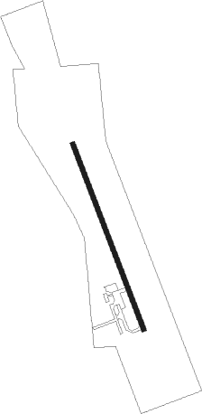
Runway info
| Runway 16 / 34 | ||
| length | 917m (3009ft) | |
| bearing | 161° / 341° | |
| width | 23m (75ft) | |
| surface | asphalt | |
Nearby beacons
| code | identifier | dist | bearing | frequency |
|---|---|---|---|---|
| FWV | TRUXNO (FARMERVILLE) NDB | 5.1 | 343° | 379 |
| ROQ | RUSTON NDB | 14.4 | 245° | 368 |
| MLU | MONROE VORTAC | 19.7 | 125° | 117.20 |
| ML | SABAR (MONROE) NDB | 20 | 139° | 392 |
| BQP | BASTROP NDB | 22.9 | 86° | 329 |
| ELD | EL DORADO VOR/DME | 37.9 | 323° | 115.50 |
| EL | LADOS (EL DORADO) NDB | 39 | 325° | 418 |
| SWB | SAWMILL (WINNFIELD) VOR/DME | 48.3 | 204° | 113.75 |
| MON | MONTICELLO VOR/DME | 59.1 | 37° | 111.60 |
Disclaimer
The information on this website is not for real aviation. Use this data with the X-Plane flight simulator only! Data taken with kind consent from X-Plane 12 source code and data files. Content is subject to change without notice.