Blountstown - Calhoun County
Airport details
| Country | United States of America |
| State | Florida |
| Region | |
| Airspace | Jacksonville Ctr |
| Municipality | Calhoun County |
| Elevation | 0ft (0m) |
| Timezone | GMT -6 |
| Coordinates | 30.48830, -85.11275 |
| Magnetic var | |
| Type | land |
| Available since | X-Plane v10.40 |
| ICAO code | F95 |
| IATA code | n/a |
| FAA code | F95 |
Communication
| Calhoun County AWOS | 119.350 |
| Calhoun County CTAF | 122.900 |
Nearby Points of Interest:
Old Calhoun County Courthouse
-Robert Lee Norton House
-St. Luke Baptist Church
-Marianna Historic District
-Theophilus West House
-Ely-Criglar House
-Joseph W. Russ Jr. House
-Great Oaks
-Erwin House
-Pender's Store
-Joshua Davis House
-Gretna School
-Willoughby Gregory House
-South Third Street Historic District
-Chipley City Hall
-E. C. Love House
-Quincy Library
-Judge P. W. White House
-E. B. Shelfer House
-Quincy Historic District
-Stockton-Curry House
-John Lee McFarlin House
-Fort Gadsden
-Dr. Malcolm Nicholson Farmhouse
-Sapp House
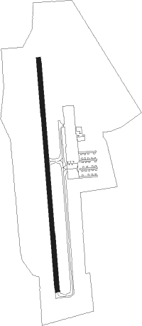
Runway info
| Runway 18 / 36 | ||
| length | 1103m (3619ft) | |
| bearing | 180° / 360° | |
| width | 20m (66ft) | |
| surface | asphalt | |
Nearby beacons
| code | identifier | dist | bearing | frequency |
|---|---|---|---|---|
| MAI | MARIANNA VORTAC | 17.9 | 358° | 114 |
| SMY | SOYYA (MARIANNA) NDB | 23.7 | 344° | 329 |
| PAM | TYNDALL (PANAMA CITY) TACAN | 34.4 | 228° | 133.70 |
| PFN | LYNNE (PANAMA CITY) NDB | 36 | 256° | 278 |
| SZW | SEMINOLE VORTAC | 38.4 | 85° | 117.50 |
| LYZ | WILLIS (BAINBRIDGE) NDB | 42 | 51° | 359 |
| RRS | WIREGRASS (DOTHAN) VORTAC | 50.5 | 338° | 111.60 |
| CYR | CAIDY (CAIRO) NDB | 54.7 | 67° | 338 |
| OZR | CAIRNS (FT RUCKER) VOR/DME | 56.5 | 322° | 111.20 |
| OZ | RUCKR (FT RUCKER) NDB | 57.2 | 316° | 212 |
| HEY | HANCHEY (FT RUCKER) VOR | 60 | 329° | 110.60 |
| HYE | HANCHEY (FT RUCKER) NDB | 60.1 | 329° | 221 |
| LOR | LOWE (FORT RUCKER) NDB | 61.6 | 324° | 269 |
| EDN | ENTERPRISE VOR | 63.3 | 316° | 116.60 |
| BVG | BOLL WEEVIL (ENTERPRISE) NDB | 67.9 | 314° | 352 |
Disclaimer
The information on this website is not for real aviation. Use this data with the X-Plane flight simulator only! Data taken with kind consent from X-Plane 12 source code and data files. Content is subject to change without notice.