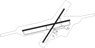
East London
Airport details
| Country | South Africa |
| State | Eastern Cape |
| Region | FA |
| Airspace | Cape Town Ctr |
| Municipality | East London |
| Elevation | 435ft (133m) |
| Timezone | GMT +2 |
| Coordinates | -33.03512, 27.82135 |
| Magnetic var | |
| Type | land |
| Available since | X-Plane v10.40 |
| ICAO code | FAEL |
| IATA code | ELS |
| FAA code | n/a |
Communication
| East London ATIS | 126.650 |
| East London Ground Control | 122.650 |
| East London Tower | 118.300 |
| East London Approach | 120.100 |
Approach frequencies
| ILS-cat-I | RW11 | 110.9 | 18.00mi |
| ILS-cat-I | RW29 | 109.9 | 18.00mi |
| 3° GS | RW11 | 110.9 | 18.00mi |
| 3° GS | RW29 | 109.9 | 18.00mi |
Nearby beacons
| code | identifier | dist | bearing | frequency |
|---|---|---|---|---|
| ELV | EAST LONDON VOR/DME | 0.1 | 136° | 114.50 |
Instrument approach procedures
| runway | airway (heading) | route (dist, bearing) |
|---|---|---|
| RW11 | ETMOT (109°) | ETMOT 4500ft EL1T1 (6mi, 171°) 3500ft |
| RW11 | IBMON (83°) | IBMON 4500ft EL1T1 (6mi, 83°) 3500ft |
| RW11 | OKBUR (56°) | OKBUR 4500ft EL1T1 (6mi, 351°) 3500ft |
| RNAV | EL1T1 3500ft EL1F1 (5mi, 83°) 2000ft EL1MP (5mi, 83°) 483ft EL1MP (turn) 990ft EL1M1 (8mi, 83°) 2020ft EL1M2 (10mi, 170°) 3550ft OKBUR (18mi, 274°) 4500ft OKBUR (turn) 4500ft | |
| RW29 | EGRAL (289°) | EGRAL 4500ft EL2T1 (6mi, 350°) 3400ft |
| RW29 | IMVAV (263°) | IMVAV 4500ft EL2T1 (6mi, 263°) 3400ft |
| RW29 | UTABU (237°) | UTABU 4500ft EL2T1 (6mi, 170°) 3400ft |
| RNAV | EL2T1 3400ft EL2F1 (5mi, 263°) 2000ft EL2MP (5mi, 263°) 435ft EL2MP (turn) 900ft EL2M1 (8mi, 263°) 1800ft EL2M2 (11mi, 171°) 3510ft EGRAL (18mi, 71°) 4500ft EGRAL (turn) 4500ft |
Disclaimer
The information on this website is not for real aviation. Use this data with the X-Plane flight simulator only! Data taken with kind consent from X-Plane 12 source code and data files. Content is subject to change without notice.

