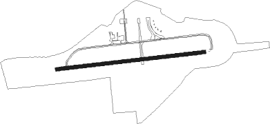
George
Airport details
| Country | South Africa |
| State | Western Cape |
| Region | FA |
| Airspace | Cape Town Ctr |
| Municipality | George Local Municipality |
| Elevation | 645ft (197m) |
| Timezone | GMT +2 |
| Coordinates | -34.00241, 22.37495 |
| Magnetic var | |
| Type | land |
| Available since | X-Plane v10.40 |
| ICAO code | FAGG |
| IATA code | GRJ |
| FAA code | n/a |
Communication
| George ATIS | 126.225 |
| George Ground | 122.650 |
| George Tower | 118.900 |
| George Approach | 128.200 |
Approach frequencies
| ILS-cat-II | RW29 | 110.1 | 18.00mi |
| ILS-cat-I | RW11 | 109.5 | 18.00mi |
| 3° GS | RW11 | 109.5 | 18.00mi |
| 3° GS | RW29 | 110.1 | 18.00mi |
Nearby beacons
| code | identifier | dist | bearing | frequency |
|---|---|---|---|---|
| GRV | GEORGE VOR/DME | 0.3 | 168° | 116.60 |
| PY | PLETTENBERG BAY NDB | 47.6 | 95° | 277 |
Departure and arrival routes
| Transition altitude | 8000ft |
| STAR starting points | distance | inbound heading | |
|---|---|---|---|
| RW11 | |||
| AXEM1A | 49.9 | 78° | |
| XALI1B | 29.8 | 240° | |
| GABG1A, GABG1B | 49.8 | 250° | |
Instrument approach procedures
| runway | airway (heading) | route (dist, bearing) |
|---|---|---|
| RW11 | ATUDI (106°) | ATUDI 7600ft GG1T1 (6mi, 176°) 5300ft |
| RW11 | EGMEP (78°) | EGMEP GG1T1 (15mi, 67°) 5300ft |
| RW11 | UTELU (70°) | UTELU 5500ft GG1T1 (6mi, 359°) 5300ft |
| RNAV | GG1T1 5300ft GG1F1 (9mi, 89°) 2500ft FAGG (6mi, 87°) 672ft FAGG (turn) 1050ft GG1M1 (5mi, 90°) GG1M2 (8mi, 177°) UTELU (21mi, 272°) 5500ft UTELU (turn) 5500ft | |
| RW29 | IMPEG (269°) | IMPEG 6500ft ETLAG (7mi, 268°) 3900ft |
| RW29 | TILAS (296°) | TILAS 5800ft ETLAG (7mi, 357°) 3900ft |
| RNAV | ETLAG 3900ft GG2F1 (5mi, 268°) 2500ft FAGG (6mi, 270°) 717ft FAGG (turn) 1050ft GG2M1 (8mi, 267°) GG2M2 (10mi, 177°) TILAS (20mi, 80°) 5800ft TILAS (turn) |
Holding patterns
| STAR name | hold at | type | turn | heading* | altitude | leg | speed limit |
|---|---|---|---|---|---|---|---|
| AXEM1A | AXEMU | VHF | right | 283 (103)° | 20000ft - 28000ft | 1.5min timed | 280 |
| GABG1A | XALIN | VHF | right | 109 (289)° | 16000ft - 28000ft | 1.5min timed | 280 |
| GABG1B | XALIN | VHF | right | 109 (289)° | 16000ft - 28000ft | 1.5min timed | 280 |
| XALI1B | XALIN | VHF | right | 109 (289)° | 16000ft - 28000ft | 1.5min timed | 280 |
| *) magnetic outbound (inbound) holding course | |||||||
Disclaimer
The information on this website is not for real aviation. Use this data with the X-Plane flight simulator only! Data taken with kind consent from X-Plane 12 source code and data files. Content is subject to change without notice.