Greytown
Airport details
| Country | South Africa |
| State | KwaZulu-Natal |
| Region | FA |
| Airspace | Johannesburg Ctr |
| Municipality | Umvoti Local Municipality |
| Elevation | 3529ft (1076m) |
| Timezone | GMT +2 |
| Coordinates | -29.12272, 30.58511 |
| Magnetic var | |
| Type | land |
| Available since | X-Plane v10.40 |
| ICAO code | FAGY |
| IATA code | n/a |
| FAA code | n/a |
Communication
| Greytown TIBA | 123.500 |
| Greytown Durban Approach | 125.750 |
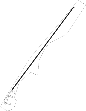
Runway info
| Runway 06 / 24 | ||
| length | 1494m (4902ft) | |
| bearing | 45° / 225° | |
| width | 11m (36ft) | |
| surface | asphalt | |
| displ threshold | 37m (121ft) / 0m (0ft) | |
| blast zone | 0m (0ft) / 6m (20ft) | |
Nearby beacons
| code | identifier | dist | bearing | frequency |
|---|---|---|---|---|
| GYV | GREYTOWN VOR/DME | 0.1 | 167° | 113.50 |
| ORI | PIETERMARITZBURG NDB | 27.1 | 197° | 442 |
| OBI | PIETERMARITZBURG NDB | 30.9 | 201° | 280 |
| PMV | PIETERMARITZBURG VOR/DME | 32.9 | 199° | 117.90 |
| PU | PIETERMARITZBURG NDB | 33.6 | 198° | 407 |
| PZ | PIETERMARITZBURG NDB | 35.7 | 193° | 257 |
| TGV | KING SHAKA (DURBAN) VOR/DME | 40.7 | 132° | 115.60 |
| LYV | LADYSMITH VOR/DME | 56.2 | 300° | 116.50 |
| UL | ULUNDI NDB | 63 | 46° | 422 |
| UL | DME | 65.4 | 46° | 115.40 |
| UD | ULUNDI NDB | 66.3 | 46° | 267 |
| SMH | ULUNDI NDB | 71.2 | 45° | 457 |
Instrument approach procedures
| runway | airway (heading) | route (dist, bearing) |
|---|---|---|
| RW24 | ETMUP (250°) | ETMUP 8100ft GY2T1 (5mi, 308°) 6500ft |
| RW24 | IBLUX (225°) | IBLUX 8100ft GY2T1 (5mi, 225°) 6500ft |
| RW24 | UDGOM (198°) | UDGOM 8100ft GY2T1 (5mi, 128°) 6500ft |
| RNAV | GY2T1 6500ft GY2T2 (3mi, 225°) 5500ft GY2F1 (2mi, 225°) 5100ft GY2F2 (3mi, 225°) 4250ft GY2MP (2mi, 225°) 3681ft GY2MP (turn) 4500ft ETMUP (11mi, 72°) ETMUP (turn) 7000ft |
Disclaimer
The information on this website is not for real aviation. Use this data with the X-Plane flight simulator only! Data taken with kind consent from X-Plane 12 source code and data files. Content is subject to change without notice.