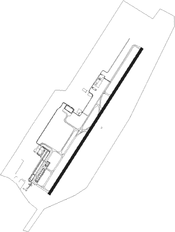
Durban - King Shaka Intl
Airport details
| Country | South Africa |
| State | KwaZulu-Natal |
| Region | FA |
| Airspace | Johannesburg Ctr |
| Municipality | eThekwini Metropolitan Municipality |
| Elevation | 299ft (91m) |
| Timezone | GMT +2 |
| Coordinates | -29.61177, 31.11931 |
| Magnetic var | |
| Type | land |
| Available since | X-Plane v10.40 |
| ICAO code | FALE |
| IATA code | DUR |
| FAA code | n/a |
Communication
| King Shaka Intl DATIS | 127.000 |
| King Shaka Intl King Shaka Ground | 121.650 |
| King Shaka Intl King Shaka Tower | 118.450 |
| King Shaka Intl Durban Approach | 125.750 |
Approach frequencies
| ILS-cat-II | RW24 | 109.7 | 18.00mi |
| ILS-cat-II | RW06 | 111.3 | 18.00mi |
| 3° GS | RW24 | 109.7 | 18.00mi |
| 3° GS | RW06 | 111.3 | 18.00mi |
Nearby Points of Interest:
Durban City Hall
Runway info
| Runway 06 / 24 | ||
| length | 3705m (12156ft) | |
| bearing | 41° / 221° | |
| width | 60m (197ft) | |
| surface | asphalt | |
| blast zone | 16m (52ft) / 20m (66ft) | |
Nearby beacons
| code | identifier | dist | bearing | frequency |
|---|---|---|---|---|
| TGV | KING SHAKA (DURBAN) VOR/DME | 0.2 | 84° | 115.60 |
| ORI | PIETERMARITZBURG NDB | 35.1 | 274° | 442 |
| PZ | PIETERMARITZBURG NDB | 35.4 | 262° | 257 |
| PU | PIETERMARITZBURG NDB | 37.1 | 266° | 407 |
| PMV | PIETERMARITZBURG VOR/DME | 37.5 | 267° | 117.90 |
| OBI | PIETERMARITZBURG NDB | 37.8 | 270° | 280 |
| GYV | GREYTOWN VOR/DME | 40.4 | 312° | 113.50 |
| RBV | RICHARDS BAY VOR/DME | 73.1 | 48° | 113 |
Departure and arrival routes
| Transition altitude | 5500ft |
| SID end points | distance | outbound heading | |
|---|---|---|---|
| RW06 | |||
| ITMI1C | 50mi | 50° | |
| TUBI1A | 50mi | 243° | |
| GYV1A | 40mi | 312° | |
| RW24 | |||
| OKTA1A | 50mi | 218° | |
| TUBI1B | 50mi | 243° | |
| GYV2B | 40mi | 312° | |
| STAR starting points | distance | inbound heading | |
|---|---|---|---|
| RW06 | |||
| DUNS1A | 49.8 | 45° | |
| GETO1C | 50.7 | 96° | |
| APMA1A | 50.1 | 168° | |
| ITMI1A | 50.2 | 230° | |
| RW24 | |||
| DUNS1B | 49.8 | 45° | |
| GETO1D | 50.7 | 96° | |
| APMA1B | 50.1 | 168° | |
| ITMI1B | 50.2 | 230° | |
Instrument approach procedures
| runway | airway (heading) | route (dist, bearing) |
|---|---|---|
| RW06 | LE1N1 (65°) | LE1N1 5000ft LE1T1 (7mi, 124°) 4000ft |
| RW06 | LE1N2 (41°) | LE1N2 5000ft LE1T1 (7mi, 41°) 4000ft |
| RW06 | LE1N3 (15°) | LE1N3 5000ft LE1T1 (7mi, 304°) 4000ft |
| RNAV | LE1T1 4000ft LE1F1 (5mi, 41°) 3000ft LE1MP (8mi, 41°) 469ft LE1M1 (10mi, 41°) LE1M2 (11mi, 124°) LE1N3 (23mi, 232°) 3000ft | |
| RW24 | LE2N1 (244°) | LE2N1 5000ft LE2T1 (7mi, 304°) 4000ft |
| RW24 | LE2N2 (221°) | LE2N2 5000ft LE2T1 (7mi, 221°) 4000ft |
| RW24 | LE2N3 (195°) | LE2N3 5300ft LE2T1 (7mi, 124°) 4000ft |
| RNAV | LE2T1 4000ft LE2F1 (5mi, 221°) 3000ft LE2MP (8mi, 221°) 355ft LE2M1 (10mi, 221°) LE2M2 (11mi, 124°) LE2N1 (23mi, 30°) 3000ft |
Holding patterns
| STAR name | hold at | type | turn | heading* | altitude | leg | speed limit |
|---|---|---|---|---|---|---|---|
| APMA1A | APMAT | VHF | left | 349 (169)° | 15000ft - 28000ft | DME 13.0mi | ICAO rules |
| APMA1B | APMAT | VHF | left | 349 (169)° | 15000ft - 28000ft | DME 13.0mi | ICAO rules |
| GETO1C | GETOK | VHF | right | 301 (121)° | 12000ft - 28000ft | DME 13.0mi | ICAO rules |
| GETO1D | GETOK | VHF | right | 301 (121)° | 12000ft - 28000ft | DME 13.0mi | ICAO rules |
| ITMI1A | ITMIL | VHF | left | 64 (244)° | 15000ft - 28000ft | DME 13.0mi | ICAO rules |
| ITMI1B | ITMIL | VHF | left | 64 (244)° | 15000ft - 28000ft | DME 13.0mi | ICAO rules |
| *) magnetic outbound (inbound) holding course | |||||||
Disclaimer
The information on this website is not for real aviation. Use this data with the X-Plane flight simulator only! Data taken with kind consent from X-Plane 12 source code and data files. Content is subject to change without notice.