Langebaanweg - Langebaanweg Ab
Airport details
| Country | South Africa |
| State | Western Cape |
| Region | FA |
| Airspace | Cape Town Ctr |
| Municipality | Saldanha Bay Local Municipality |
| Elevation | 106ft (32m) |
| Timezone | GMT +2 |
| Coordinates | -32.96881, 18.16526 |
| Magnetic var | |
| Type | land |
| Available since | X-Plane v10.40 |
| ICAO code | FALW |
| IATA code | SDB |
| FAA code | n/a |
Communication
| Langebaanweg AB Ground Control | 121.750 |
| Langebaanweg AB Tower | 128.800 |
| Langebaanweg AB Tower | 120.800 |
| Langebaanweg AB Approach | 122.500 |
Approach frequencies
| ILS-cat-I | RW20L | 108.9 | 18.00mi |
| 3° GS | RW20L | 108.9 | 18.00mi |
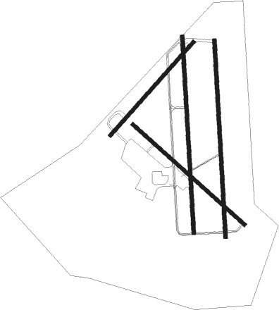
Runway info
Runway 02L / 20R  | ||
| length | 2343m (7687ft) | |
| bearing | 1° / 181° | |
| width | 46m (151ft) | |
| surface | asphalt | |
| blast zone | 100m (328ft) / 0m (0ft) | |
| Runway 02R / 20L | ||
| length | 2343m (7687ft) | |
| bearing | 1° / 181° | |
| width | 46m (151ft) | |
| surface | asphalt | |
| blast zone | 0m (0ft) / 70m (230ft) | |
| Runway 07 / 25 | ||
| length | 1493m (4898ft) | |
| bearing | 51° / 231° | |
| width | 46m (151ft) | |
| surface | asphalt | |
| Runway 16 / 34 | ||
| length | 1788m (5866ft) | |
| bearing | 131° / 311° | |
| width | 44m (144ft) | |
| surface | asphalt | |
| blast zone | 204m (669ft) / 0m (0ft) | |
Nearby beacons
| code | identifier | dist | bearing | frequency |
|---|---|---|---|---|
| LWV | LANGEBAANWEG VOR/DME | 0.8 | 186° | 117 |
| LW | LANGEBAANWEG NDB | 1 | 233° | 345 |
| SVV | SOMERSVELD VOR | 23 | 132° | 113 |
| RIV | ROBBEN ISLAND VOR/DME | 50.8 | 167° | 117.60 |
| CB | CAPE TOWN NDB | 58.2 | 156° | 462 |
Departure and arrival routes
| Transition altitude | 5000ft |
| SID end points | distance | outbound heading | |
|---|---|---|---|
| RW02R | |||
| BERG1B | 14mi | 59° | |
| HOPE1B | 16mi | 150° | |
| RW20L | |||
| BERG1A | 14mi | 59° | |
| HOPE1A | 16mi | 150° | |
| STAR starting points | distance | inbound heading | |
|---|---|---|---|
| RW02R | |||
| HOPE2B | 23.0 | 312° | |
| RW20L | |||
| HOPE2A | 23.0 | 312° | |
Disclaimer
The information on this website is not for real aviation. Use this data with the X-Plane flight simulator only! Data taken with kind consent from X-Plane 12 source code and data files. Content is subject to change without notice.