Margate
Airport details
| Country | South Africa |
| State | KwaZulu-Natal |
| Region | FA |
| Airspace | Johannesburg Ctr |
| Municipality | Hibiscus Coast Local Municipality |
| Elevation | 495ft (151m) |
| Timezone | GMT +2 |
| Coordinates | -30.85909, 30.34329 |
| Magnetic var | |
| Type | land |
| Available since | X-Plane v10.40 |
| ICAO code | FAMG |
| IATA code | MGH |
| FAA code | n/a |
Communication
| Margate Margate Radio | 122.700 |
Runway info
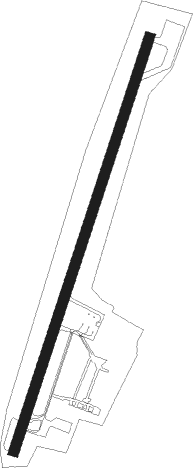
| Runway 05 / 23 | ||
| length | 1334m (4377ft) | |
| bearing | 26° / 206° | |
| width | 30m (98ft) | |
| surface | asphalt | |
Nearby beacons
| code | identifier | dist | bearing | frequency |
|---|---|---|---|---|
| SI | LUSIKISIKI NDB | 49.5 | 243° | 200 |
| PJV | PORT ST JOHNS VOR | 61.7 | 228° | 115.90 |
Instrument approach procedures
| runway | airway (heading) | route (dist, bearing) |
|---|---|---|
| RW05 | ETGON (58°) | ETGON 3900ft MG1T1 (5mi, 110°) 2600ft |
| RW05 | IBNAG (26°) | IBNAG 3900ft MG1T1 (6mi, 26°) 2600ft |
| RW05 | UNDAV (345°) | UNDAV 3700ft MG1T1 (6mi, 290°) 2600ft |
| RNAV | MG1T1 2600ft MG1F1 (5mi, 26°) 1500ft MG1MP (3mi, 26°) 538ft (2534mi, 315°) 910ft MG1M1 (2533mi, 135°) MG1M2 (6mi, 110°) UNDAV (12mi, 206°) 3700ft UNDAV (turn) 3700ft | |
| RW23 | EVURU (239°) | EVURU 3800ft MG2T1 (6mi, 290°) 2600ft |
| RW23 | OKMAV (169°) | OKMAV 4000ft MG2T1 (6mi, 110°) 2600ft |
| RW23 | UTSIP (206°) | UTSIP 4000ft MG2T1 (6mi, 206°) 2600ft |
| RNAV | MG2T1 2600ft MG2F1 (5mi, 206°) 1800ft MG2MP (4mi, 206°) 526ft (2534mi, 315°) 910ft MG2M1 (2535mi, 136°) MG2M2 (6mi, 110°) EVURU (13mi, 26°) 3800ft EVURU (turn) 3800ft |
Disclaimer
The information on this website is not for real aviation. Use this data with the X-Plane flight simulator only! Data taken with kind consent from X-Plane 12 source code and data files. Content is subject to change without notice.