Orient
Airport details
| Country | South Africa |
| State | Gauteng |
| Region | FA |
| Airspace | Johannesburg Ctr |
| Municipality | Mogale City Local Municipality |
| Elevation | 5100ft (1554m) |
| Timezone | GMT +2 |
| Coordinates | -26.03907, 27.59748 |
| Magnetic var | |
| Type | land |
| Available since | X-Plane v10.40 |
| ICAO code | FAOI |
| IATA code | n/a |
| FAA code | n/a |
Communication
| Orient ATC Frequncy | 123.400 |
Nearby Points of Interest:
Coopers Cave
-Drimolen
-Paardekraal Monument
-Plovers Lake
-Gladysvale Cave
-Swartkrans
-Gondolin Cave
-James Mpanza House
-Witwatersrand Gold Rush
-Chancellor House
-Johannesburg City Library
-Weskoppies Psychiatric Hospital
-Witkop Blockhouse
-Palace of Justice (South Africa)
-Ou Raadsaal
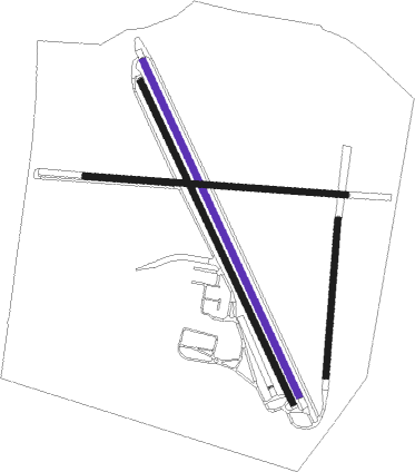
Runway info
| Runway 18L / 36R | ||
| length | 1426m (4678ft) | |
| bearing | 157° / 337° | |
| width | 24m (80ft) | |
| surface | grass | |
Runway 18R / 36L  | ||
| length | 1376m (4514ft) | |
| bearing | 157° / 337° | |
| width | 24m (80ft) | |
| surface | grass | |
| Runway 11 / 29 | ||
| length | 1014m (3327ft) | |
| bearing | 98° / 278° | |
| width | 24m (80ft) | |
| surface | grass | |
| Runway 01 / 19 | ||
| length | 605m (1985ft) | |
| bearing | 10° / 190° | |
| width | 24m (80ft) | |
| surface | grass | |
Nearby beacons
| code | identifier | dist | bearing | frequency |
|---|---|---|---|---|
| LA | LANSERIA NDB | 13.1 | 83° | 270 |
| LIV | LANSERIA VOR/DME | 17.9 | 74° | 117.40 |
| GAV | GRASMERE VOR | 28.8 | 171° | 115.50 |
| RG | RUSTENBURG NDB | 28.8 | 321° | 452 |
| GC | GRAND CENTRAL NDB | 29.4 | 85° | 372 |
| RD | RAND (JOHANNESBURG) NDB | 31.2 | 119° | 307 |
| RAV | RAND (JOHANNESBURG) VOR/DME | 32.4 | 110° | 117.70 |
| JSV | JOHANNESBURG VOR/DME | 34.8 | 101° | 115.20 |
| WKV | WATERKLOOF VOR/DME | 35.8 | 72° | 116.90 |
| VV | VEREENIGING NDB | 37.1 | 146° | 460 |
| DPV | WONDERBOOM VOR/DME | 40.7 | 58° | 112.20 |
| WR | WONDERBOOM (PRETORIA) NDB | 41.8 | 59° | 230 |
| RA | RAND NDB | 42.6 | 120° | 337 |
| WB | WONDERBOOM (PRETORIA) NDB | 44.3 | 61° | 257 |
| PNV | PILANESBERG VOR/DME | 46.3 | 324° | 112.60 |
| HGV | HEIDELBERG VOR | 54 | 134° | 116.70 |
| MEV | BRONKHORSTSPRUIT VOR/DME | 54.1 | 76° | 114.30 |
| CZV | ZONDERWATER VOR/DME | 55.6 | 70° | 114.30 |
| KD | KLERKSDORP NDB | 67.9 | 228° | 280 |
Disclaimer
The information on this website is not for real aviation. Use this data with the X-Plane flight simulator only! Data taken with kind consent from X-Plane 12 source code and data files. Content is subject to change without notice.