Polokwane - Polokwane Intl
Airport details
| Country | South Africa |
| State | Limpopo |
| Region | FA |
| Airspace | Johannesburg Ctr |
| Municipality | Polokwane Local Municipality |
| Elevation | 4076ft (1242m) |
| Timezone | GMT +2 |
| Coordinates | -23.84965, 29.45649 |
| Magnetic var | |
| Type | land |
| Available since | X-Plane v10.40 |
| ICAO code | FAPP |
| IATA code | PTG |
| FAA code | n/a |
Communication
Approach frequencies
| ILS-cat-I | RW05 | 108.7 | 18.00mi |
| 3° GS | RW05 | 108.7 | 18.00mi |
Nearby Points of Interest:
Makapansgat
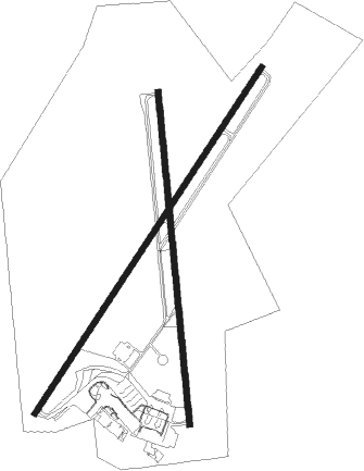
Runway info
Runway 01 / 19  | ||
| length | 2570m (8432ft) | |
| bearing | 359° / 179° | |
| width | 45m (148ft) | |
| surface | asphalt | |
| blast zone | 100m (328ft) / 100m (328ft) | |
| Runway 05 / 23 | ||
| length | 3194m (10479ft) | |
| bearing | 40° / 220° | |
| width | 45m (148ft) | |
| surface | asphalt | |
| displ threshold | 0m (0ft) / 855m (2805ft) | |
| blast zone | 58m (190ft) / 0m (0ft) | |
Nearby beacons
| code | identifier | dist | bearing | frequency |
|---|---|---|---|---|
| PPV | POLOKWANE VOR/DME | 0.6 | 23° | 114.50 |
| LTV | MAKHADO VOR/DME | 43.3 | 18° | 115 |
| TZ | TZANEEN NDB | 49.7 | 87° | 212 |
| LO | LOUIS TRICHARDT NDB | 51.5 | 26° | 457 |
| TOY | THOHOYANDOU NDB | 66.3 | 48° | 285 |
Instrument approach procedures
| runway | airway (heading) | route (dist, bearing) |
|---|---|---|
| RW05 | EPRUP (69°) | EPRUP 8800ft PP1T1 (6mi, 126°) 7000ft |
| RW05 | IMGAK (41°) | IMGAK 8800ft PP1T1 (6mi, 40°) 7000ft |
| RW05 | UDBIM (9°) | UDBIM 8000ft PP1T1 (6mi, 306°) 7000ft |
| RNAV | PP1T1 7000ft PP1T2 (4mi, 40°) 6000ft PP1F1 (2mi, 40°) 5500ft PP1MP (4mi, 40°) 4194ft PP1M1 (6mi, 40°) PP1M2 (9mi, 306°) 7600ft EPRUP (15mi, 211°) 8800ft EPRUP (turn) 8800ft |
Disclaimer
The information on this website is not for real aviation. Use this data with the X-Plane flight simulator only! Data taken with kind consent from X-Plane 12 source code and data files. Content is subject to change without notice.