Potchefstroom
Airport details
| Country | South Africa |
| State | North West |
| Region | FA |
| Airspace | Johannesburg Ctr |
| Municipality | Tlokwe Local Municipality |
| Elevation | 4520ft (1378m) |
| Timezone | GMT +2 |
| Coordinates | -26.66829, 27.08411 |
| Magnetic var | |
| Type | land |
| Available since | X-Plane v10.40 |
| ICAO code | FAPS |
| IATA code | PCF |
| FAA code | n/a |
Communication
| Potchefstroom Potchefstroom | 123.000 |
Nearby Points of Interest:
Vredefort crater
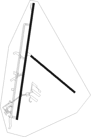
Runway info
Runway 03 / 21  | ||
| length | 1811m (5942ft) | |
| bearing | 14° / 194° | |
| width | 30m (98ft) | |
| surface | asphalt | |
| displ threshold | 0m (0ft) / 34m (112ft) | |
| Runway 15 / 33 | ||
| length | 871m (2858ft) | |
| bearing | 131° / 311° | |
| width | 30m (98ft) | |
| surface | grass | |
Nearby beacons
| code | identifier | dist | bearing | frequency |
|---|---|---|---|---|
| KD | KLERKSDORP NDB | 22.6 | 245° | 280 |
| GAV | GRASMERE VOR | 33.1 | 75° | 115.50 |
| VV | VEREENIGING NDB | 47.3 | 83° | 460 |
| LA | LANSERIA NDB | 56.6 | 49° | 270 |
| LIV | LANSERIA VOR/DME | 62.1 | 49° | 117.40 |
Disclaimer
The information on this website is not for real aviation. Use this data with the X-Plane flight simulator only! Data taken with kind consent from X-Plane 12 source code and data files. Content is subject to change without notice.