Rustenburg
Airport details
| Country | South Africa |
| State | North West |
| Region | FA |
| Airspace | Johannesburg Ctr |
| Municipality | Rustenburg Local Municipality |
| Elevation | 3700ft (1128m) |
| Timezone | GMT +2 |
| Coordinates | -25.65000, 27.28333 |
| Magnetic var | |
| Type | land |
| Available since | X-Plane v10.40 |
| ICAO code | FARG |
| IATA code | n/a |
| FAA code | n/a |
Communication
| Rustenburg TIBA | 122.400 |
Nearby Points of Interest:
Gladysvale Cave
-Drimolen
-Swartkrans
-Gondolin Cave
-Plovers Lake
-Coopers Cave
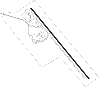
Runway info
| Runway 16 / 34 | ||
| length | 1272m (4173ft) | |
| bearing | 142° / 322° | |
| width | 15m (51ft) | |
| surface | asphalt | |
Nearby beacons
| code | identifier | dist | bearing | frequency |
|---|---|---|---|---|
| RG | RUSTENBURG NDB | 0 | 0° | 452 |
| PNV | PILANESBERG VOR/DME | 17.5 | 328° | 112.60 |
| LA | LANSERIA NDB | 37 | 123° | 270 |
| LIV | LANSERIA VOR/DME | 38.5 | 115° | 117.40 |
| GC | GRAND CENTRAL NDB | 50.6 | 112° | 372 |
| DPV | WONDERBOOM VOR/DME | 50.7 | 90° | 112.20 |
| WKV | WATERKLOOF VOR/DME | 51.8 | 101° | 116.90 |
| WR | WONDERBOOM (PRETORIA) NDB | 51.9 | 90° | 230 |
| GAV | GRASMERE VOR | 56.1 | 156° | 115.50 |
| RAV | RAND (JOHANNESBURG) VOR/DME | 59 | 124° | 117.70 |
| RD | RAND (JOHANNESBURG) NDB | 59 | 129° | 307 |
| JSV | JOHANNESBURG VOR/DME | 59.5 | 118° | 115.20 |
| VV | VEREENIGING NDB | 66 | 144° | 460 |
| RA | RAND NDB | 70.4 | 128° | 337 |
Disclaimer
The information on this website is not for real aviation. Use this data with the X-Plane flight simulator only! Data taken with kind consent from X-Plane 12 source code and data files. Content is subject to change without notice.