Secunda
Airport details
| Country | South Africa |
| State | Mpumalanga |
| Region | FA |
| Airspace | Johannesburg Ctr |
| Municipality | Govan Mbeki Local Municipality |
| Elevation | 5240ft (1597m) |
| Timezone | GMT +2 |
| Coordinates | -26.52056, 29.17222 |
| Magnetic var | |
| Type | land |
| Available since | X-Plane v10.40 |
| ICAO code | FASC |
| IATA code | ZEC |
| FAA code | n/a |
Communication
| Secunda Secunda Radio | 122.000 |
Runway info
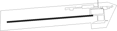
| Runway 11 / 29 | ||
| length | 1101m (3612ft) | |
| bearing | 90° / 270° | |
| width | 18m (59ft) | |
| surface | asphalt | |
Nearby beacons
| code | identifier | dist | bearing | frequency |
|---|---|---|---|---|
| TU | TUTUKA NDB | 15.6 | 137° | 352 |
| STV | STANDERTON VOR | 19.4 | 240° | 116 |
| WIV | WITBANK VOR | 41.5 | 2° | 113.30 |
| MAJ | MAJUBA NDB | 44.5 | 133° | 512 |
| HGV | HEIDELBERG VOR | 48.8 | 259° | 116.70 |
| RA | RAND NDB | 49.1 | 276° | 337 |
| MEV | BRONKHORSTSPRUIT VOR/DME | 54.8 | 320° | 114.30 |
| JSV | JOHANNESBURG VOR/DME | 55.1 | 291° | 115.20 |
| CZV | ZONDERWATER VOR/DME | 60.1 | 323° | 114.30 |
| WKV | WATERKLOOF VOR/DME | 65.8 | 306° | 116.90 |
| WB | WONDERBOOM (PRETORIA) NDB | 70 | 315° | 257 |
| WR | WONDERBOOM (PRETORIA) NDB | 72.2 | 313° | 230 |
| DPV | WONDERBOOM VOR/DME | 73 | 312° | 112.20 |
Disclaimer
The information on this website is not for real aviation. Use this data with the X-Plane flight simulator only! Data taken with kind consent from X-Plane 12 source code and data files. Content is subject to change without notice.