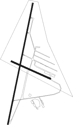
Springs
Airport details
| Country | South Africa |
| State | Gauteng |
| Region | FA |
| Airspace | Johannesburg Ctr |
| Municipality | City of Ekurhuleni Metropolitan Municipa |
| Elevation | 5338ft (1627m) |
| Timezone | GMT +2 |
| Coordinates | -26.25000, 28.40000 |
| Magnetic var | |
| Type | land |
| Available since | X-Plane v10.40 |
| ICAO code | FASI |
| IATA code | n/a |
| FAA code | n/a |
Communication
| Springs Springs Tower | 122.400 |
Nearby Points of Interest:
Johannesburg City Library
-Chancellor House
-Witkop Blockhouse
-Witwatersrand Gold Rush
-James Mpanza House
-Van Wouw Museum
-Old Merensky Library
-Pretoria National Botanical Garden
-Weskoppies Psychiatric Hospital
-Union Buildings
-Palace of Justice (South Africa)
-Ou Raadsaal
-Paardekraal Monument

Nearby beacons
| code | identifier | dist | bearing | frequency |
|---|---|---|---|---|
| JSV | JOHANNESBURG VOR/DME | 10.6 | 299° | 115.20 |
| RA | RAND NDB | 12.7 | 218° | 337 |
| RAV | RAND (JOHANNESBURG) VOR/DME | 13.2 | 271° | 117.70 |
| RD | RAND (JOHANNESBURG) NDB | 17.1 | 258° | 307 |
| GC | GRAND CENTRAL NDB | 20.8 | 315° | 372 |
| WKV | WATERKLOOF VOR/DME | 26.8 | 337° | 116.90 |
| HGV | HEIDELBERG VOR | 27.5 | 195° | 116.70 |
| MEV | BRONKHORSTSPRUIT VOR/DME | 28.9 | 19° | 114.30 |
| VV | VEREENIGING NDB | 30.4 | 234° | 460 |
| LIV | LANSERIA VOR/DME | 31.8 | 302° | 117.40 |
| LA | LANSERIA NDB | 33.4 | 293° | 270 |
| CZV | ZONDERWATER VOR/DME | 34.6 | 15° | 114.30 |
| WB | WONDERBOOM (PRETORIA) NDB | 36 | 350° | 257 |
| STV | STANDERTON VOR | 36.7 | 134° | 116 |
| WR | WONDERBOOM (PRETORIA) NDB | 36.7 | 345° | 230 |
| DPV | WONDERBOOM VOR/DME | 36.9 | 343° | 112.20 |
| GAV | GRASMERE VOR | 42 | 250° | 115.50 |
| WIV | WITBANK VOR | 49.7 | 62° | 113.30 |
| TU | TUTUKA NDB | 58.7 | 116° | 352 |
Disclaimer
The information on this website is not for real aviation. Use this data with the X-Plane flight simulator only! Data taken with kind consent from X-Plane 12 source code and data files. Content is subject to change without notice.