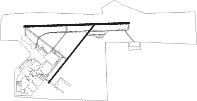
Pretoria - Wonderboom
Airport details
| Country | South Africa |
| State | Gauteng |
| Region | FA |
| Airspace | Johannesburg Ctr |
| Municipality | Pretoria |
| Elevation | 4095ft (1248m) |
| Timezone | GMT +2 |
| Coordinates | -25.65679, 28.21617 |
| Magnetic var | |
| Type | land |
| Available since | X-Plane v10.40 |
| ICAO code | FAWB |
| IATA code | PRY |
| FAA code | n/a |
Communication
| Wonderboom Ground Control | 120.600 |
| Wonderboom Tower | 118.350 |
| Wonderboom Departure | 118.350 |
Nearby Points of Interest:
Union Buildings
-Ou Raadsaal
-Palace of Justice (South Africa)
-Pretoria National Botanical Garden
-Old Merensky Library
-Weskoppies Psychiatric Hospital
-Van Wouw Museum
-Gondolin Cave
-Swartkrans
-Gladysvale Cave
-Plovers Lake
-Drimolen
-Coopers Cave
-Johannesburg City Library
-Chancellor House
-Paardekraal Monument
-Witwatersrand Gold Rush

Nearby beacons
| code | identifier | dist | bearing | frequency |
|---|---|---|---|---|
| DPV | WONDERBOOM VOR/DME | 0.2 | 77° | 112.20 |
| WR | WONDERBOOM (PRETORIA) NDB | 1.4 | 85° | 230 |
| WB | WONDERBOOM (PRETORIA) NDB | 4.4 | 90° | 257 |
| WKV | WATERKLOOF VOR/DME | 10.6 | 179° | 116.90 |
| CZV | ZONDERWATER VOR/DME | 18.2 | 96° | 114.30 |
| MEV | BRONKHORSTSPRUIT VOR/DME | 20.3 | 111° | 114.30 |
| GC | GRAND CENTRAL NDB | 20.5 | 193° | 372 |
| LIV | LANSERIA VOR/DME | 23.9 | 226° | 117.40 |
| LA | LANSERIA NDB | 29.4 | 227° | 270 |
| JSV | JOHANNESBURG VOR/DME | 30 | 178° | 115.20 |
| RAV | RAND (JOHANNESBURG) VOR/DME | 35.5 | 186° | 117.70 |
| RD | RAND (JOHANNESBURG) NDB | 40 | 191° | 307 |
| RA | RAND NDB | 46.1 | 176° | 337 |
| RG | RUSTENBURG NDB | 50.5 | 270° | 452 |
| WIV | WITBANK VOR | 53.9 | 100° | 113.30 |
| VV | VEREENIGING NDB | 56.4 | 196° | 460 |
| GAV | GRASMERE VOR | 59.1 | 212° | 115.50 |
Instrument approach procedures
| runway | airway (heading) | route (dist, bearing) |
|---|---|---|
| RW29 | ETUPU (272°) | ETUPU 9000ft WB2T1 (6mi, 272°) 6600ft |
| RW29 | IMSOL (296°) | IMSOL 9000ft WB2T1 (5mi, 350°) 6600ft |
| RW29 | TIKUT (247°) | TIKUT 7000ft WB2T1 (5mi, 183°) 6600ft |
| RNAV | WB2T1 6600ft WB2F1 (5mi, 272°) 5100ft FAWB (4mi, 269°) 4145ft FAWB (turn) 4500ft WB2M1 (7mi, 41°) 6100ft TIKUT (5mi, 99°) 7000ft |
Disclaimer
The information on this website is not for real aviation. Use this data with the X-Plane flight simulator only! Data taken with kind consent from X-Plane 12 source code and data files. Content is subject to change without notice.