Cape Town - Ysterplaat
Airport details
| Country | South Africa |
| State | Western Cape |
| Region | FA |
| Airspace | Cape Town Ctr |
| Municipality | Cape Town |
| Elevation | 47ft (14m) |
| Timezone | GMT +2 |
| Coordinates | -33.90287, 18.49294 |
| Magnetic var | |
| Type | land |
| Available since | X-Plane v10.40 |
| ICAO code | FAYP |
| IATA code | n/a |
| FAA code | n/a |
Communication
| Ysterplaat Ground Control | 121.850 |
| Ysterplaat Tower | 125.600 |
| Ysterplaat CAPE TOWN Approach | 119.700 |
Nearby Points of Interest:
Groote Schuur Hospital
-Rondebosch Common
-Cape Town City Hall
-Martin Melck House
-National Library of South Africa
-Rust en Vreugd
-Tuynhuys
-Huguenot Memorial Building
-Table Mountain
-Cape Floristic Region
-Boschendal
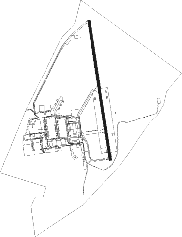
Runway info
| Runway 02 / 20 | ||
| length | 1587m (5207ft) | |
| bearing | 355° / 175° | |
| width | 29m (95ft) | |
| surface | hard surface | |
Nearby beacons
| code | identifier | dist | bearing | frequency |
|---|---|---|---|---|
| CB | CAPE TOWN NDB | 4.3 | 72° | 462 |
| CTV | CAPE TOWN VOR/DME | 6.8 | 121° | 115.70 |
| RIV | ROBBEN ISLAND VOR/DME | 8.9 | 309° | 117.60 |
| SVV | SOMERSVELD VOR | 39.2 | 359° | 113 |
| WC | WORCESTER NDB | 48.3 | 75° | 335 |
| CDV | CALEDON VOR | 50.6 | 102° | 114.90 |
| LWV | LANGEBAANWEG VOR/DME | 57.6 | 340° | 117 |
| LW | LANGEBAANWEG NDB | 57.9 | 340° | 345 |
| CSV | CERES VOR/DME | 61.3 | 55° | 114.20 |
Disclaimer
The information on this website is not for real aviation. Use this data with the X-Plane flight simulator only! Data taken with kind consent from X-Plane 12 source code and data files. Content is subject to change without notice.