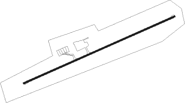
Kasane
Airport details
| Country | Botswana |
| State | Chobe District |
| Region | FB |
| Airspace | Gaborone Ctr |
| Elevation | 3289ft (1002m) |
| Timezone | GMT +2 |
| Coordinates | -17.83085, 25.16260 |
| Magnetic var | |
| Type | land |
| Available since | X-Plane v10.40 |
| ICAO code | FBKE |
| IATA code | BBK |
| FAA code | n/a |
Communication
| KASANE Tower | 118.600 |
| KASANE Approach | 127.200 |
Nearby beacons
| code | identifier | dist | bearing | frequency |
|---|---|---|---|---|
| KAV | KASANE VOR/DME | 0.3 | 111° | 113.30 |
| KAS | KASANE NDB | 0.5 | 322° | 287 |
| LZ | HARRY NKUMBULA NDB | 36.1 | 89° | 308 |
| FO | VICTORIA FALLS NDB | 37 | 112° | 256 |
| VLI | HARRY NKUMBULA VOR/DME | 37.6 | 88° | 112.50 |
| VFA | VICTORIA FALLS VOR/DME | 40.3 | 112° | 116.70 |
| MT | MATETSI NDB | 58.8 | 132° | 260 |
Departure and arrival routes
| Transition altitude | 7000ft |
| SID end points | distance | outbound heading | |
|---|---|---|---|
| RW08 | |||
| UNLU1C | 101mi | 175° | |
| NERE1C | 82mi | 219° | |
| STAR starting points | distance | inbound heading | |
|---|---|---|---|
| RW08 | |||
| NERE1A | 81.6 | 39° | |
| UNLU1A | 100.9 | 355° | |
Instrument approach procedures
| runway | airway (heading) | route (dist, bearing) |
|---|---|---|
| RW08 | EPROT (95°) | EPROT 6000ft KE401 (5mi, 160°) 5000ft |
| RW08 | NEVET (71°) | NEVET 6000ft KE401 (5mi, 71°) 5000ft |
| RW08 | SHALA (47°) | SHALA 6000ft KE401 (5mi, 340°) 5000ft |
| RNAV | KE401 5000ft KE402 (5mi, 72°) 5000ft FBKE (6mi, 70°) 3339ft SHALA (12mi, 227°) 6000ft SHALA (turn) 6000ft |
Disclaimer
The information on this website is not for real aviation. Use this data with the X-Plane flight simulator only! Data taken with kind consent from X-Plane 12 source code and data files. Content is subject to change without notice.
