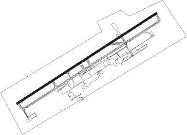
Gaborone - Sir Seretse Khama Intl
Airport details
| Country | Botswana |
| State | South-East District |
| Region | FB |
| Airspace | Gaborone Ctr |
| Municipality | Gaborone |
| Elevation | 3296ft (1005m) |
| Timezone | GMT +2 |
| Coordinates | -24.56560, 25.90752 |
| Magnetic var | |
| Type | land |
| Available since | X-Plane v10.40 |
| ICAO code | FBSK |
| IATA code | GBE |
| FAA code | n/a |
Communication
| Sir Seretse Khama Intl KHAMA Ground Control | 121.900 |
| Sir Seretse Khama Intl KHAMA Tower | 118.300 |
Approach frequencies
| ILS-cat-I | RW08 | 109.9 | 18.00mi |
| 3° GS | RW08 | 109.9 | 18.00mi |
Nearby beacons
| code | identifier | dist | bearing | frequency |
|---|---|---|---|---|
| GSV | GABORONE VOR/DME | 1.1 | 44° | 114 |
| GBV | GABORONE VOR/DME | 4.5 | 247° | 113.70 |
| GBE | GABORONE NDB | 5.5 | 61° | 311 |
Departure and arrival routes
| Transition altitude | 7000ft |
| SID end points | distance | outbound heading | |
|---|---|---|---|
| RW08 | |||
| UDMO2A | 62mi | 23° | |
| UDBU2A | 49mi | 139° | |
| TESO2A | 70mi | 287° | |
| UTVI2A | 66mi | 327° | |
| RW26 | |||
| UDMO1B | 62mi | 23° | |
| UDBU1B | 49mi | 139° | |
| TESO1B | 70mi | 287° | |
| UTVI1B | 66mi | 327° | |
| STAR starting points | distance | inbound heading | |
|---|---|---|---|
| RW08 | |||
| DULT2C | 38.1 | 85° | |
| UTVI2C | 65.8 | 147° | |
| UVBI2C | 41.2 | 206° | |
| DUSL2C | 47.3 | 299° | |
| RW26 | |||
| DULT1D | 38.1 | 85° | |
| UTVI1D | 65.8 | 147° | |
| UVBI1D | 41.2 | 206° | |
| DUSL1D | 47.3 | 299° | |
Instrument approach procedures
| runway | airway (heading) | route (dist, bearing) |
|---|---|---|
| RW08 | BONDY (35°) | BONDY 6000ft 3NM (3mi, 329°) 5500ft SK401 (3mi, 329°) 5100ft |
| RW08 | ESVON (65°) | ESVON 6000ft SK401 (6mi, 64°) 5100ft |
| RW08 | OKPEX (92°) | OKPEX 6000ft SK401 (6mi, 149°) 5100ft |
| RNAV | SK401 5100ft SK402 (5mi, 64°) 5100ft FBSK (6mi, 66°) 3341ft IBRAB (19mi, 63°) IBRAB (turn) 6000ft | |
| RW26 | IBRAB (243°) | IBRAB 6000ft SK403 (6mi, 244°) 5100ft |
| RW26 | KOFTA (266°) | KOFTA 6000ft SK403 (6mi, 329°) 5100ft |
| RW26 | UTIMO (218°) | UTIMO 6000ft SK403 (6mi, 149°) 5100ft |
| RNAV | SK403 5100ft SK404 (5mi, 244°) 5100ft FBSK (8mi, 242°) 3326ft SK405 (6mi, 246°) SK406 (6mi, 149°) SK407 (4mi, 110°) KOFTA (17mi, 53°) KOFTA (turn) 6000ft |
Disclaimer
The information on this website is not for real aviation. Use this data with the X-Plane flight simulator only! Data taken with kind consent from X-Plane 12 source code and data files. Content is subject to change without notice.
