Jupiter - Tailwinds
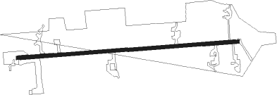
Airport details
| Country | United States of America |
| State | Florida |
| Region | |
| Airspace | Miami Oceanic Ctr |
| Municipality | Martin County |
| Elevation | 19ft (6m) |
| Timezone | GMT -5 |
| Coordinates | 26.97678, -80.22215 |
| Magnetic var | |
| Type | land |
| Available since | X-Plane v10.40 |
| ICAO code | FD15 |
| IATA code | n/a |
| FAA code | FD15 |
Communication
Nearby Points of Interest:
Trapper Nelson Zoo Historic District
-Olympia School
-Hobe Sound National Wildlife Refuge
-Gate House
-Jupiter Inlet Historic and Archeological Site
-Golden Gate Building
-Krueger House
-Kelsey City City Hall
-Lyric Theatre
-Old Martin County Courthouse
-Tuckahoe
-Northboro Park Historic District
-Old Northwood Historic District
-Pine Ridge Hospital
-Northwest Historic District
-Mickens House
-Clematis Street Historic Commercial District
-Grant Van Valkenburg House
-Hatch's Department Store
-Old Palm Beach Junior College Building
-Alfred J. Comeau House
-Comeau Building
-Palm Beach Mercantile Company
-American National Bank Building
-William Gray Warden House
Nearby beacons
| code | identifier | dist | bearing | frequency |
|---|---|---|---|---|
| UTX | UNITED NDB | 7.3 | 239° | 405 |
| PBI | PALM BEACH VORTAC | 19.2 | 155° | 115.70 |
| PHK | PAHOKEE VOR/DME | 27.7 | 248° | 115.40 |
| FPR | FORT PIERCE NDB | 31.6 | 343° | 275 |
| TRV | TREASURE (VERO BEACH) VORTAC | 44.4 | 339° | 117.30 |
| FX | PRAIZ (FT LAUDERDALE) NDB | 47.6 | 186° | 221 |
| FLL | FORT LAUDERDALE VOR/DME | 54.3 | 176° | 114.40 |
Disclaimer
The information on this website is not for real aviation. Use this data with the X-Plane flight simulator only! Data taken with kind consent from X-Plane 12 source code and data files. Content is subject to change without notice.