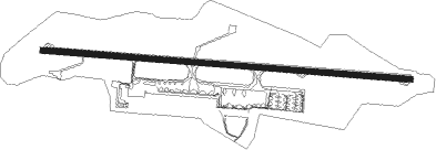
Antananarivo - Ivato
Airport details
| Country | Madagascar |
| State | Analamanga |
| Region | FM |
| Airspace | Antananarivo Ctr |
| Municipality | Antananarivo |
| Elevation | 4151ft (1265m) |
| Timezone | GMT +3 |
| Coordinates | -18.79652, 47.47609 |
| Magnetic var | |
| Type | land |
| Available since | X-Plane v10.40 |
| ICAO code | FMMI |
| IATA code | TNR |
| FAA code | n/a |
Communication
| Ivato Tower | 120.100 |
| Ivato Approach | 125.700 |
Approach frequencies
| ILS-cat-II | RW11 | 109.5 | 18.00mi |
| 3° GS | RW11 | 109.5 | 18.00mi |
Nearby beacons
| code | identifier | dist | bearing | frequency |
|---|---|---|---|---|
| IA | IVATO (ANTANANARIVO) NDB | 1.2 | 278° | 364 |
| TAN | ANTANETIBE (ANTANANARIVO) NDB | 2.3 | 186° | 276 |
| TNV | ANTANANARIVO VOR/DME | 2.4 | 99° | 115.10 |
| IO | IVATO (ANTANANARIVO) NDB | 4.7 | 279° | 305 |
| NT | IVATO (ANTANANARIVO) NDB | 7.3 | 98° | 370 |
| TN | ANKAZOBE NDB | 35.4 | 323° | 385 |
| TE | MORAMANGA NDB | 43.6 | 102° | 371 |
| TW | SOAVINANDRIANA NDB | 47.7 | 243° | 350 |
Departure and arrival routes
| Transition altitude | 8000ft |
| SID end points | distance | outbound heading | |
|---|---|---|---|
| RW11 | |||
| TAPA1E | 25mi | 13° | |
| GATL1E | 151mi | 32° | |
| SEME1E | 25mi | 36° | |
| IXAR1E | 74mi | 71° | |
| RAMU1E | 25mi | 73° | |
| PIPR1E | 25mi | 102° | |
| ODRE1E | 25mi | 156° | |
| MJ4E | 153mi | 160° | |
| NANO1E | 25mi | 183° | |
| VSF4E | 160mi | 188° | |
| MENI1E | 25mi | 214° | |
| LIKI1E | 25mi | 242° | |
| IKRA1E | 25mi | 285° | |
| KEKI1E | 25mi | 324° | |
| RW29 | |||
| TAPA1W | 25mi | 13° | |
| GATL1W | 151mi | 32° | |
| SEME1W | 25mi | 36° | |
| IXAR1W | 74mi | 71° | |
| RAMU1W | 25mi | 73° | |
| PIPR1W | 25mi | 102° | |
| ODRE1W | 25mi | 156° | |
| MJ2W | 153mi | 160° | |
| NANO1W | 25mi | 183° | |
| VSF2W | 160mi | 188° | |
| MENI1W | 25mi | 214° | |
| LIKI1W | 25mi | 242° | |
| IKRA1W | 25mi | 285° | |
| KEKI1W | 25mi | 324° | |
| STAR starting points | distance | inbound heading | |
|---|---|---|---|
| RW11 | |||
| NANO1G | 25.1 | 3° | |
| VSF1B | 160.1 | 8° | |
| LIKI1B | 25.0 | 62° | |
| TAPA1D | 25.1 | 193° | |
| GATL1Z, GATL1B | 151.3 | 212° | |
| IXAR1B, IXAR1Z | 73.8 | 251° | |
| ODRE1G | 25.0 | 336° | |
| MJ2B | 153.1 | 340° | |
| RW29 | |||
| NANO1U | 25.1 | 3° | |
| LIKI1U | 25.0 | 62° | |
| TAPA1K | 25.1 | 193° | |
| GATL1A, GATL1V | 151.3 | 212° | |
| IXAR2A, IXAR1V | 73.8 | 251° | |
| ODRE1U | 25.0 | 336° | |
| MJ2A, MJ2D | 153.1 | 340° | |
Instrument approach procedures
| runway | airway (heading) | route (dist, bearing) |
|---|---|---|
| RW11 | DEKIR (117°) | DEKIR 7000ft BALBY (5mi, 189°) 7000ft |
| RW11 | GAGIS (80°) | GAGIS 7000ft BALBY (5mi, 9°) 7000ft |
| RNAV | BALBY 7000ft MI501 (5mi, 99°) 7000ft FMMI (9mi, 99°) 4247ft MI502 (6mi, 98°) DEKIR (21mi, 291°) 7000ft | |
| RW29 | KEPOS (261°) | KEPOS 7000ft ANOSI (5mi, 189°) 7000ft |
| RW29 | UBILA (296°) | UBILA 7000ft ANOSI (5mi, 9°) 7000ft |
| RNAV | ANOSI 7000ft MI503 (6mi, 278°) 7000ft FMMI (10mi, 278°) 4167ft MI504 (6mi, 278°) KEPOS (22mi, 86°) 7000ft |
Holding patterns
| STAR name | hold at | type | turn | heading* | altitude | leg | speed limit |
|---|---|---|---|---|---|---|---|
| AT1Z | IO | FIX | right | 114 (294)° | 8000ft - 11000ft | 1.0min timed | 230 |
| AT2A | ANOSI | VHF | left | 114 (294)° | 7000ft - 11000ft | 1.0min timed | 230 |
| AT2B | BALBY | VHF | right | 294 (114)° | 7000ft - 11000ft | 1.0min timed | 230 |
| GATL1A | ANOSI | VHF | left | 114 (294)° | 7000ft - 11000ft | 1.0min timed | 230 |
| GATL1B | BALBY | VHF | right | 294 (114)° | 7000ft - 11000ft | 1.0min timed | 230 |
| GATL1Z | IO | FIX | right | 114 (294)° | 8000ft - 11000ft | 1.0min timed | 230 |
| IKRA1B | BALBY | VHF | right | 294 (114)° | 7000ft - 11000ft | 1.0min timed | 230 |
| IXAR1B | BALBY | VHF | right | 294 (114)° | 7000ft - 11000ft | 1.0min timed | 230 |
| IXAR1Z | IO | FIX | right | 114 (294)° | 8000ft - 11000ft | 1.0min timed | 230 |
| IXAR2A | ANOSI | VHF | left | 114 (294)° | 7000ft - 11000ft | 1.0min timed | 230 |
| KEKI1B | BALBY | VHF | right | 294 (114)° | 7000ft - 11000ft | 1.0min timed | 230 |
| LIKI1B | BALBY | VHF | right | 294 (114)° | 7000ft - 11000ft | 1.0min timed | 230 |
| MJ2A | ANOSI | VHF | left | 114 (294)° | 7000ft - 11000ft | 1.0min timed | 230 |
| MJ2B | BALBY | VHF | right | 294 (114)° | 7000ft - 11000ft | 1.0min timed | 230 |
| MJ2D | ANOSI | VHF | left | 114 (294)° | 7000ft - 11000ft | 1.0min timed | 230 |
| MJ2Z | IO | FIX | right | 114 (294)° | 8000ft - 11000ft | 1.0min timed | 230 |
| PIPR1A | ANOSI | VHF | left | 114 (294)° | 7000ft - 11000ft | 1.0min timed | 230 |
| RAMU1A | ANOSI | VHF | left | 114 (294)° | 7000ft - 11000ft | 1.0min timed | 230 |
| TE1A | ANOSI | VHF | left | 114 (294)° | 7000ft - 11000ft | 1.0min timed | 230 |
| TE1B | BALBY | VHF | right | 294 (114)° | 7000ft - 11000ft | 1.0min timed | 230 |
| TE1Z | IO | FIX | right | 114 (294)° | 8000ft - 11000ft | 1.0min timed | 230 |
| TN1A | ANOSI | VHF | left | 114 (294)° | 7000ft - 11000ft | 1.0min timed | 230 |
| TN1Z | IO | FIX | right | 114 (294)° | 8000ft - 11000ft | 1.0min timed | 230 |
| TN2B | BALBY | VHF | right | 294 (114)° | 7000ft - 11000ft | 1.0min timed | 230 |
| TN2D | BALBY | VHF | right | 294 (114)° | 7000ft - 11000ft | 1.0min timed | 230 |
| TW1A | ANOSI | VHF | left | 114 (294)° | 7000ft - 11000ft | 1.0min timed | 230 |
| TW1B | BALBY | VHF | right | 294 (114)° | 7000ft - 11000ft | 1.0min timed | 230 |
| TW1Z | IO | FIX | right | 114 (294)° | 8000ft - 11000ft | 1.0min timed | 230 |
| TW2D | BALBY | VHF | right | 294 (114)° | 7000ft - 11000ft | 1.0min timed | 230 |
| VSF1B | BALBY | VHF | right | 294 (114)° | 7000ft - 11000ft | 1.0min timed | 230 |
| VSF2Z | IO | FIX | right | 114 (294)° | 8000ft - 11000ft | 1.0min timed | 230 |
| VSQ1Z | IO | FIX | right | 114 (294)° | 8000ft - 11000ft | 1.0min timed | 230 |
| VSQ2B | BALBY | VHF | right | 294 (114)° | 7000ft - 11000ft | 1.0min timed | 230 |
| *) magnetic outbound (inbound) holding course | |||||||
Disclaimer
The information on this website is not for real aviation. Use this data with the X-Plane flight simulator only! Data taken with kind consent from X-Plane 12 source code and data files. Content is subject to change without notice.