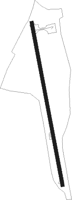
Sainte Marie
Airport details
| Country | Madagascar |
| State | Analanjirofo |
| Region | FM |
| Airspace | Antananarivo Ctr |
| Municipality | District de Nosy Boraha |
| Elevation | 6ft (2m) |
| Timezone | GMT +3 |
| Coordinates | -17.09028, 49.81556 |
| Magnetic var | |
| Type | land |
| Available since | X-Plane v10.40 |
| ICAO code | FMMS |
| IATA code | SMS |
| FAA code | n/a |
Communication
| Sainte Marie AFIS | 120.300 |
Nearby beacons
| code | identifier | dist | bearing | frequency |
|---|---|---|---|---|
| SM | SAINTE-MARIE NDB | 0 | 227° | 290 |
| TO | TOAMASINA NDB | 62.1 | 204° | 394 |
Disclaimer
The information on this website is not for real aviation. Use this data with the X-Plane flight simulator only! Data taken with kind consent from X-Plane 12 source code and data files. Content is subject to change without notice.