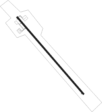
Franceville - Mvengue
Airport details
| Country | Gabon |
| State | Haut-Ogooué Province |
| Region | FO |
| Airspace | Brazzaville Ctr |
| Municipality | Franceville |
| Elevation | 1450ft (442m) |
| Timezone | GMT +1 |
| Coordinates | -1.65186, 13.43480 |
| Magnetic var | |
| Type | land |
| Available since | X-Plane v10.40 |
| ICAO code | FOON |
| IATA code | MVB |
| FAA code | n/a |
Communication
| MVENGUE MVENGUE Tower | 118.200 |
Approach frequencies
| ILS-cat-I | RW15 | 110.1 | 18.00mi |
| 3° GS | RW15 | 110.1 | 18.00mi |
Runway info
| Runway 15 / 33 | ||
| length | 3088m (10131ft) | |
| bearing | 144° / 324° | |
| width | 45m (148ft) | |
| surface | asphalt | |
| blast zone | 60m (197ft) / 120m (394ft) | |
Nearby beacons
| code | identifier | dist | bearing | frequency |
|---|---|---|---|---|
| FRV | FRANCEVILLE VOR/DME | 0.5 | 98° | 116.10 |
| FRN | FRANCEVILLE NDB | 3.6 | 324° | 295 |
Instrument approach procedures
| runway | airway (heading) | route (dist, bearing) |
|---|---|---|
| RW15 | ARKUS (122°) | ARKUS 3700ft DEKER (5mi, 53°) 3500ft |
| RW15 | LIGAS (165°) | LIGAS 3500ft DEKER (5mi, 233°) 3500ft |
| RNAV | DEKER 3500ft ON501 (6mi, 144°) 3500ft FRN (3mi, 144°) 2440ft FOON (4mi, 144°) 1487ft ON502 (5mi, 144°) LIGAS (18mi, 340°) 3500ft | |
| RW33 | BISIL (303°) | BISIL 3500ft PIPMO (5mi, 233°) 3500ft |
| RW33 | MOLUG (344°) | MOLUG 3500ft PIPMO (5mi, 53°) 3500ft |
| RNAV | PIPMO 3500ft ON503 (6mi, 324°) 3500ft FOON (8mi, 324°) 1461ft ON504 (4mi, 324°) BISIL (18mi, 127°) 3500ft |
Disclaimer
The information on this website is not for real aviation. Use this data with the X-Plane flight simulator only! Data taken with kind consent from X-Plane 12 source code and data files. Content is subject to change without notice.
