Beira
Airport details
| Country | Mozambique |
| State | Sofala Province |
| Region | FQ |
| Airspace | Beira Ctr |
| Municipality | Beira |
| Elevation | 33ft (10m) |
| Timezone | GMT +2 |
| Coordinates | -19.79583, 34.90479 |
| Magnetic var | |
| Type | land |
| Available since | X-Plane v10.40 |
| ICAO code | FQBR |
| IATA code | BEW |
| FAA code | n/a |
Communication
| Beira Ground Control | 121.900 |
| Beira Tower | 118.100 |
| Beira TETE INFO | 127.900 |
| Beira TETE INFO | 125.900 |
| Beira Approach | 119.900 |
Approach frequencies
| ILS-cat-I | RW12 | 110.3 | 18.00mi |
| 3° GS | RW12 | 110.3 | 18.00mi |
Nearby Points of Interest:
Beira Airport
-Beira railway station
-Casa dos Bicos
-Fort São Caetano
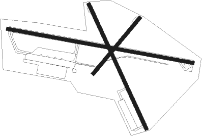
Runway info
Runway 12 / 30  | ||
| length | 2393m (7851ft) | |
| bearing | 104° / 284° | |
| width | 45m (148ft) | |
| surface | asphalt | |
| Runway 17 / 35 | ||
| length | 1748m (5735ft) | |
| bearing | 159° / 339° | |
| width | 45m (148ft) | |
| surface | asphalt | |
| Runway 06 / 24 | ||
| length | 920m (3018ft) | |
| bearing | 46° / 226° | |
| width | 45m (148ft) | |
| surface | asphalt | |
| blast zone | 255m (837ft) / 0m (0ft) | |
Nearby beacons
| code | identifier | dist | bearing | frequency |
|---|---|---|---|---|
| VBR | BEIRA VOR/DME | 1.9 | 284° | 113.70 |
Departure and arrival routes
| Transition altitude | 2000ft |
| SID end points | distance | outbound heading | |
|---|---|---|---|
| RW12 | |||
| EPNA1A | 75mi | 18° | |
| ANVO1A | 49mi | 114° | |
| APMA1A | 86mi | 171° | |
| EVOG1A | 76mi | 340° | |
| RW30 | |||
| ANVI1B | 75mi | 18° | |
| ANVO1B | 49mi | 114° | |
| APMU1B | 86mi | 171° | |
| AVEX1B | 77mi | 296° | |
| EVOG1B | 76mi | 340° | |
| STAR starting points | distance | inbound heading | |
|---|---|---|---|
| RW12 | |||
| ETLA1A | 75.2 | 22° | |
| IBMO1A | 76.9 | 116° | |
| NIBA1A | 76.4 | 160° | |
| NETA1A | 75.3 | 198° | |
| NESE1A | 74.2 | 224° | |
| ETBE1A | 48.9 | 294° | |
| UDKA1A | 85.6 | 351° | |
| RW30 | |||
| ETLA1B | 75.2 | 22° | |
| ERDI1B | 41.7 | 113° | |
| IBMO1B | 76.9 | 116° | |
| NIBA1B | 76.4 | 160° | |
| NETA1B | 75.3 | 198° | |
| NESE1B | 74.2 | 224° | |
| ETBE1B | 48.9 | 294° | |
| UDKA1B | 85.6 | 351° | |
Instrument approach procedures
| runway | airway (heading) | route (dist, bearing) |
|---|---|---|
| RW12 | AVUNU (78°) | AVUNU 3300ft EGLUK (6mi, 16°) 1800ft |
| RW12 | ERDET (104°) | ERDET 3300ft EGLUK (6mi, 104°) 1800ft |
| RW12 | EXADU (131°) | EXADU 3300ft EGLUK (6mi, 196°) 1800ft |
| RNAV | EGLUK 1800ft EPNAB (6mi, 104°) 1800ft FQBR (5mi, 104°) 82ft (2372mi, 300°) 440ft EVOBA (2390mi, 119°) 1500ft | |
| RW30 | APREK (259°) | APREK 3300ft APMUN (6mi, 196°) 1800ft |
| RW30 | AXISA (310°) | AXISA 3300ft APMUN (6mi, 16°) 1800ft |
| RW30 | EVOBA (284°) | EVOBA 3300ft APMUN (6mi, 284°) 1800ft |
| RNAV | APMUN 1800ft APLAB (6mi, 284°) 1800ft FQBR (6mi, 284°) 86ft (2372mi, 300°) 440ft ERDET (2355mi, 120°) 1500ft |
Disclaimer
The information on this website is not for real aviation. Use this data with the X-Plane flight simulator only! Data taken with kind consent from X-Plane 12 source code and data files. Content is subject to change without notice.