Pemba / Porto Amelia - Pemba
Airport details
| Country | Mozambique |
| State | Cabo Delgado Province |
| Region | FQ |
| Airspace | Beira Ctr |
| Municipality | Pemba |
| Elevation | 331ft (101m) |
| Timezone | GMT +2 |
| Coordinates | -12.99165, 40.52425 |
| Magnetic var | |
| Type | land |
| Available since | X-Plane v10.40 |
| ICAO code | FQPB |
| IATA code | POL |
| FAA code | n/a |
Communication
| Pemba Tower | 118.400 |
Nearby Points of Interest:
Pemba Airport
-St. Paul's Cathedral, Pemba
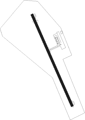
Runway info
| Runway 17 / 35 | ||
| length | 1794m (5886ft) | |
| bearing | 160° / 340° | |
| width | 45m (148ft) | |
| surface | asphalt | |
Nearby beacons
| code | identifier | dist | bearing | frequency |
|---|---|---|---|---|
| PB | PEMBA NDB | 1.9 | 340° | 280 |
Instrument approach procedures
| runway | airway (heading) | route (dist, bearing) |
|---|---|---|
| RW17 | IBTIG (187°) | IBTIG NIGUV (5mi, 251°) IBGID (5mi, 160°) 1900ft |
| RW17 | XAKOS (134°) | XAKOS NIGUV (5mi, 71°) IBGID (5mi, 160°) 1900ft |
| RNAV | IBGID 1900ft FQPB (5mi, 160°) 387ft PB600 (5mi, 160°) PB601 (5mi, 71°) IBTIG (15mi, 340°) 2900ft IBTIG (turn) 2900ft |
Disclaimer
The information on this website is not for real aviation. Use this data with the X-Plane flight simulator only! Data taken with kind consent from X-Plane 12 source code and data files. Content is subject to change without notice.