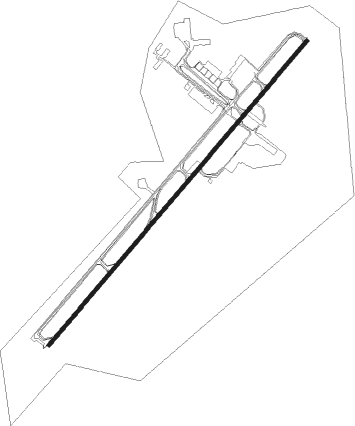
Harare - Robert Gabriel Mugabe Intl
Airport details
| Country | Zimbabwe |
| State | Harare |
| Region | FV |
| Airspace | Harare Ctr |
| Municipality | Chitungwiza |
| Elevation | 4898ft (1493m) |
| Timezone | GMT +2 |
| Coordinates | -17.93047, 31.08886 |
| Magnetic var | |
| Type | land |
| Available since | X-Plane v10.40 |
| ICAO code | FVHA |
| IATA code | HRE |
| FAA code | n/a |
Communication
| Robert Gabriel Mugabe Intl ATIS | 113.100 |
| Robert Gabriel Mugabe Intl Ground Control | 127.300 |
| Robert Gabriel Mugabe Intl Tower | 118.100 |
| Robert Gabriel Mugabe Intl Approach | 119.100 |
Nearby beacons
| code | identifier | dist | bearing | frequency |
|---|---|---|---|---|
| SI | ROBERT GABRIEL MUGABE INTL NDB | 1.7 | 219° | 330 |
| VHA | HARARE VOR/DME | 2.1 | 52° | 113.10 |
| OL | ROBERT GABRIEL MUGABE INTL NDB | 5.1 | 224° | 346 |
| CP | CHARLES PRINCE (HARARE) NDB | 14.2 | 318° | 414 |
| BZ | BROMLEY (HARARE) NDB | 16.4 | 119° | 284 |
| NZ | NORTON (HARARE) NDB | 23.1 | 273° | 373 |
| KU | MAKUMBI (HARARE) NDB | 26.2 | 23° | 363 |
Disclaimer
The information on this website is not for real aviation. Use this data with the X-Plane flight simulator only! Data taken with kind consent from X-Plane 12 source code and data files. Content is subject to change without notice.
