Mutare
Airport details
| Country | Zimbabwe |
| State | Manicaland Province |
| Region | |
| Airspace | Harare Ctr |
| Municipality | Mutare |
| Elevation | 3410ft (1039m) |
| Timezone | GMT +2 |
| Coordinates | -18.99541, 32.62308 |
| Magnetic var | |
| Type | land |
| Available since | X-Plane v10.40 |
| ICAO code | FVMU |
| IATA code | UTA |
| FAA code | n/a |
Communication
Runway info
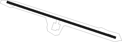
| Runway 12 / 30 | ||
| length | 951m (3120ft) | |
| bearing | 112° / 292° | |
| width | 18m (59ft) | |
| surface | gravel | |
Nearby beacons
| code | identifier | dist | bearing | frequency |
|---|---|---|---|---|
| MU | MUTARE NDB | 3.9 | 33° | 405 |
| GR | MUTARE NDB | 9.9 | 277° | 379 |
| CH | CHIMOIO NDB | 46.4 | 98° | 282 |
Disclaimer
The information on this website is not for real aviation. Use this data with the X-Plane flight simulator only! Data taken with kind consent from X-Plane 12 source code and data files. Content is subject to change without notice.