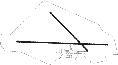
Blantyre - Chileka Intl
Airport details
| Country | Malawi |
| State | Blantyre |
| Region | FW |
| Airspace | Lilongwe Ctr |
| Elevation | 2555ft (779m) |
| Timezone | GMT +2 |
| Coordinates | -15.67979, 34.96759 |
| Magnetic var | |
| Type | land |
| Available since | X-Plane v10.40 |
| ICAO code | FWCL |
| IATA code | BLZ |
| FAA code | n/a |
Communication
| Chileka Intl Tower | 118.100 |
| Chileka Intl Approach | 124.900 |
| Chileka Intl Departure | 124.900 |
Approach frequencies
| ILS-cat-II | RW10 | 110.3 | 18.00mi |
| 3° GS | RW10 | 110.3 | 18.00mi |
Nearby beacons
| code | identifier | dist | bearing | frequency |
|---|---|---|---|---|
| NC | CHILEKA (BLANTYRE) NDB | 0.8 | 282° | 356 |
| VCL | CHILEKA (BLANTYRE) VOR/DME | 2.9 | 278° | 113.30 |
Departure and arrival routes
| Transition altitude | 7000ft |
| SID end points | distance | outbound heading | |
|---|---|---|---|
| RW10 | |||
| EGSI1A | 47mi | 103° | |
| UVDA1A, OKMA1E | 52mi | 225° | |
| LABL1E | 52mi | 252° | |
| MIRO1E | 56mi | 273° | |
| XUBO1A | 55mi | 301° | |
| TETE1E | 68mi | 327° | |
| RW28 | |||
| EGSI1B | 47mi | 103° | |
| OKMA1W, XADO1A | 52mi | 225° | |
| LABL1W | 52mi | 252° | |
| MIRO1W | 56mi | 273° | |
| UVDA1B | 55mi | 301° | |
| XUBO1B, TETE1W | 68mi | 327° | |
| RW33 | |||
| OKMA1A | 52mi | 225° | |
| LABL1A | 52mi | 252° | |
| MIRO1A | 56mi | 273° | |
| TETE1A | 68mi | 327° | |
| STAR starting points | distance | inbound heading | |
|---|---|---|---|
| RW10 | |||
| OKMA1A, OKMA1B | 52.1 | 45° | |
| LABL1A | 52.4 | 72° | |
| KAVA1A | 58.3 | 98° | |
| UVBA1A | 55.2 | 121° | |
| TETE1A | 68.1 | 147° | |
| MELN1A | 46.9 | 283° | |
| RW28 | |||
| OKMA1C | 52.1 | 45° | |
| LABL1B | 52.4 | 72° | |
| KAVA1B | 58.3 | 98° | |
| UVBA1B | 55.2 | 121° | |
| TETE1B | 68.1 | 147° | |
Instrument approach procedures
| runway | airway (heading) | route (dist, bearing) |
|---|---|---|
| RW10 | UVKEP (70°) | UVKEP 6500ft UVARU (6mi, 7°) 4100ft |
| RW10 | UVKOK (97°) | UVKOK 6500ft UVARU (6mi, 96°) 4100ft |
| RW10 | UVMAG (123°) | UVMAG 6500ft UVARU (6mi, 187°) 4100ft |
| RNAV | UVARU 4100ft UVINO (6mi, 96°) 4100ft FWCL (6mi, 97°) 2522ft EGLOD (13mi, 60°) 6900ft UVKOK (29mi, 261°) UVKOK (turn) | |
| RW28 | EGLOD (240°) | EGLOD 6900ft XAGLO (6mi, 178°) 6400ft 33NM (2mi, 268°) 6400ft XADAK (3mi, 268°) 4300ft |
| RW28 | XADIS (268°) | XADIS 6900ft XAGLO (6mi, 268°) 6400ft 33NM (2mi, 268°) 6400ft XADAK (3mi, 268°) 4300ft |
| RNAV | XADAK 4300ft 24NM (3mi, 267°) 3440ft FWCL (3mi, 267°) 2605ft UVKOK (18mi, 277°) 6900ft |
Disclaimer
The information on this website is not for real aviation. Use this data with the X-Plane flight simulator only! Data taken with kind consent from X-Plane 12 source code and data files. Content is subject to change without notice.

