Gobabis
Airport details
| Country | Namibia |
| State | Omaheke |
| Region | FY |
| Airspace | Windhoek Ctr |
| Elevation | 4729ft (1441m) |
| Timezone | GMT +2 |
| Coordinates | -22.50472, 18.97472 |
| Magnetic var | |
| Type | land |
| Available since | X-Plane v10.40 |
| ICAO code | FYGB |
| IATA code | GOG |
| FAA code | n/a |
Communication
Nearby Points of Interest:
German Lazaret
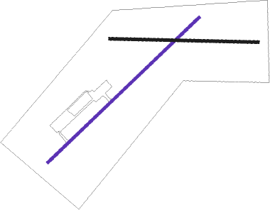
Runway info
| Runway 07 / 25 | ||
| length | 2261m (7418ft) | |
| bearing | 53° / 233° | |
| width | 30m (98ft) | |
| surface | gravel | |
| displ threshold | 5m (16ft) / 5m (16ft) | |
| blast zone | 5m (16ft) / 5m (16ft) | |
Runway 11 / 29  | ||
| length | 1599m (5246ft) | |
| bearing | 95° / 275° | |
| width | 30m (98ft) | |
| surface | gravel | |
| displ threshold | 5m (16ft) / 5m (16ft) | |
| blast zone | 5m (16ft) / 5m (16ft) | |
Disclaimer
The information on this website is not for real aviation. Use this data with the X-Plane flight simulator only! Data taken with kind consent from X-Plane 12 source code and data files. Content is subject to change without notice.