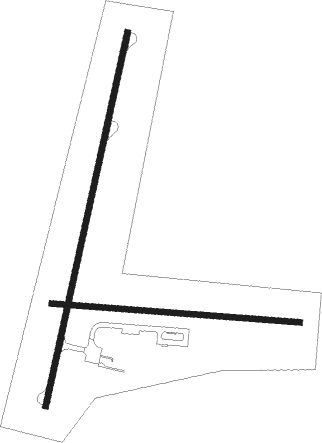
Luderitz
Airport details
| Country | Namibia |
| State | Karas |
| Region | FY |
| Airspace | Windhoek Ctr |
| Elevation | 457ft (139m) |
| Timezone | GMT +1 |
| Coordinates | -26.68528, 15.24556 |
| Magnetic var | |
| Type | land |
| Available since | X-Plane v10.40 |
| ICAO code | FYLZ |
| IATA code | LUD |
| FAA code | n/a |
Communication
| LUDERITZ CTAF | 124.800 |
| LUDERITZ Tower | 118.600 |
Instrument approach procedures
| runway | airway (heading) | route (dist, bearing) |
|---|---|---|
| RW04 | APNAV (350°) | APNAV 4000ft LZ04I (5mi, 285°) LZ04F (5mi, 19°) 2100ft |
| RW04 | ETOPA (47°) | ETOPA 4000ft LZ04I (5mi, 105°) LZ04F (5mi, 19°) 2100ft |
| RW04 | TESUM (19°) | TESUM 4000ft LZ04I (5mi, 19°) LZ04F (5mi, 19°) 2100ft |
| RNAV | LZ04F 2100ft FYLZ (5mi, 20°) 470ft LZM01 (3mi, 16°) ETOPA (14mi, 221°) ETOPA (turn) 4000ft | |
| RW22 | HERSH (198°) | HERSH 4500ft LZ22I (5mi, 199°) LZ22F (5mi, 199°) 2000ft |
| RW22 | NIKAN (170°) | NIKAN 4000ft LZ22I (5mi, 105°) LZ22F (5mi, 199°) 2000ft |
| RW22 | UNDUN (225°) | UNDUN 4500ft LZ22I (5mi, 285°) LZ22F (5mi, 199°) 2000ft |
| RNAV | LZ22F 2000ft FYLZ (5mi, 197°) 442ft LZM02 (2mi, 201°) NIKAN (14mi, 355°) NIKAN (turn) 4000ft |
Disclaimer
The information on this website is not for real aviation. Use this data with the X-Plane flight simulator only! Data taken with kind consent from X-Plane 12 source code and data files. Content is subject to change without notice.

