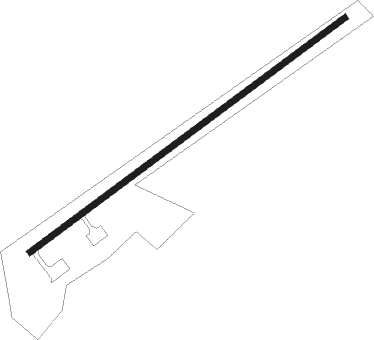
Kalemie
Airport details
| Country | Congo |
| State | Tanganyika |
| Region | FZ |
| Airspace | Kinshasa Ctr |
| Municipality | Kalemie |
| Elevation | 2567ft (782m) |
| Timezone | GMT +2 |
| Coordinates | -5.87954, 29.24528 |
| Magnetic var | |
| Type | land |
| Available since | X-Plane v10.40 |
| ICAO code | FZRF |
| IATA code | FMI |
| FAA code | n/a |
Communication
| Kalemie Tower | 118.100 |
| Kalemie Tower | 118.700 |
Runway info
| Runway 06 / 24 | ||
| length | 1744m (5722ft) | |
| bearing | 58° / 238° | |
| width | 27m (90ft) | |
| surface | asphalt | |
Nearby beacons
| code | identifier | dist | bearing | frequency |
|---|---|---|---|---|
| KMI | KALEMIE VOR | 0.8 | 20° | 116.30 |
| KG | KIGOMA NDB | 64.6 | 23° | 394 |
Departure and arrival routes
| Transition altitude | 6000ft |
| SID end points | distance | outbound heading | |
|---|---|---|---|
| RW06 | |||
| BIPG2D | 20mi | 2° | |
| AGIB2D | 20mi | 184° | |
| RW24 | |||
| BIPG2C | 20mi | 2° | |
| AGIB2C | 20mi | 184° | |
| STAR starting points | distance | inbound heading | |
|---|---|---|---|
| RW06 | |||
| AGIB2B | 19.8 | 4° | |
| BIPG2B | 20.3 | 182° | |
| RW24 | |||
| AGIB2A | 19.8 | 4° | |
| BIPG2A | 20.3 | 182° | |
Instrument approach procedures
| runway | airway (heading) | route (dist, bearing) |
|---|---|---|
| RW06 | BEBAX (27°) | BEBAX 7000ft R06C1 (5mi, 338°) 5200ft |
| RW06 | LUXAL (58°) | LUXAL 7000ft R06C1 (5mi, 58°) 5200ft |
| RW06 | OKDUK (90°) | OKDUK 7000ft R06C1 (5mi, 138°) 5200ft |
| RNAV | R06C1 5200ft R06F1 (4mi, 58°) 3700ft FZRF (3mi, 59°) 2603ft R06M1 (3mi, 57°) NIGIM (10mi, 79°) 6000ft NIGIM (turn) | |
| RW24 | ADEMA (213°) | ADEMA 7500ft R24C1 (5mi, 158°) 5700ft |
| RW24 | EMDOT (238°) | EMDOT 7500ft R24C1 (5mi, 238°) 5700ft |
| RW24 | LUMEV (263°) | LUMEV 7500ft R24C1 (5mi, 318°) 5700ft |
| RNAV | R24C1 5700ft R24F1 (5mi, 238°) 4000ft FZRF (5mi, 237°) 2597ft ULSOL (14mi, 238°) 6000ft ULSOL (turn) |
Disclaimer
The information on this website is not for real aviation. Use this data with the X-Plane flight simulator only! Data taken with kind consent from X-Plane 12 source code and data files. Content is subject to change without notice.
