Gao
Airport details
| Country | Mali |
| State | Gao |
| Region | GA |
| Airspace | Niamey Ctr |
| Elevation | 870ft (265m) |
| Timezone | GMT +0 |
| Coordinates | 16.25037, -0.00596 |
| Magnetic var | |
| Type | land |
| Available since | X-Plane v10.40 |
| ICAO code | GAGO |
| IATA code | GAQ |
| FAA code | n/a |
Communication
| gao Tower | 118.100 |
Runway info
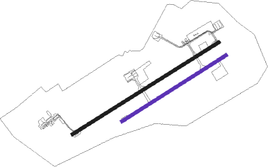
| Runway 07R / 25L | ||
| length | 1801m (5909ft) | |
| bearing | 63° / 243° | |
| width | 45m (148ft) | |
| surface | gravel | |
Runway 07L / 25R  | ||
| length | 2524m (8281ft) | |
| bearing | 63° / 243° | |
| width | 45m (148ft) | |
| surface | asphalt | |
| blast zone | 9m (30ft) / 18m (59ft) | |
Instrument approach procedures
| runway | airway (heading) | route (dist, bearing) |
|---|---|---|
| RW06L | AREMA (38°) | AREMA 2500ft DILBA (5mi, 332°) 2500ft |
| RW06L | DILBA (63°) | DILBA 2500ft |
| RW06L | TUTOL (87°) | TUTOL 2500ft DILBA (5mi, 152°) 2500ft |
| RNAV | DILBA 2500ft GO501 (5mi, 63°) 2500ft GAGO (6mi, 62°) 885ft GO502 (4mi, 65°) AREMA (16mi, 225°) 2500ft | |
| RW24R | AKLIX (244°) | AKLIX 2600ft |
| RW24R | BONBA (219°) | BONBA 2600ft AKLIX (5mi, 152°) 2600ft |
| RW24R | GATAP (268°) | GATAP 2600ft AKLIX (5mi, 332°) 2600ft |
| RNAV | AKLIX 2600ft GO503 (5mi, 243°) 2600ft GAGO (6mi, 244°) 912ft GO504 (4mi, 242°) GATAP (16mi, 81°) 2600ft |
Disclaimer
The information on this website is not for real aviation. Use this data with the X-Plane flight simulator only! Data taken with kind consent from X-Plane 12 source code and data files. Content is subject to change without notice.