Airports for X-Plane offers a convenient way to explore airports and their related communication information for the X-Plane flight simulator. It only uses data from the X-Plane flight simulator itself, and is therefore more reliable than the data that comes from real aviation websites. You can search for airports by using the ICAO code, or browse for airports per country and state. The information displayed is categorized by airport details, runway information, airport communication, approach frequencies (ILS and Glidepath details), details of nearby beacons, SIDs, STARs and approach procedures.

arrival airspeed station non-towered airport near passengers hospital stol public transport flights field bus aircraft carrier rail transport airfield traffic pattern airbase heliport southwest airfield control tower

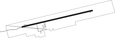
Kayes - Kayes Dag Dag

Airport details

CountryMali
StateKayes
RegionGA
AirspaceDakar Ctr
Elevation164ft (50m)
TimezoneGMT +0
Coordinates14.48171, -11.40194
Magnetic var
Typeland
Available sinceX-Plane v10.40
ICAO codeGAKY
IATA codeKYS
FAA coden/a

Communication

Kayes Dag Dag Tower118.100
Kayes Dag Dag GAKD_Tower128.800

Runway info

Runway 09 / 27
 length2815m (9236ft)
 bearing81° / 261°
 width45m (148ft)
 surfaceasphalt
 displ threshold60m (197ft) / 60m (197ft)

Airport layout


Parking locations

Nearby beacons

codeidentifierdistbearingfrequency
KAYKAYES VOR/DME1.1262°116.70

Disclaimer

The information on this website is not for real aviation. Use this data with the X-Plane flight simulator only! Data taken with kind consent from X-Plane 12 source code and data files. Content is subject to change without notice.