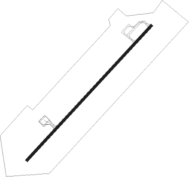
Mopti
Airport details
| Country | Mali |
| State | Mopti |
| Region | GA |
| Airspace | Dakar Ctr |
| Elevation | 910ft (277m) |
| Timezone | GMT +0 |
| Coordinates | 14.50895, -4.08577 |
| Magnetic var | |
| Type | land |
| Available since | X-Plane v10.40 |
| ICAO code | GAMB |
| IATA code | MZI |
| FAA code | n/a |
Communication
| Mopti ATC Tower | 118.200 |
Nearby Points of Interest:
Inner Niger Delta
Runway info
| Runway 05 / 23 | ||
| length | 2547m (8356ft) | |
| bearing | 48° / 228° | |
| width | 37m (120ft) | |
| surface | asphalt | |
| displ threshold | 38m (125ft) / 40m (131ft) | |
| blast zone | 62m (203ft) / 60m (197ft) | |
Nearby beacons
| code | identifier | dist | bearing | frequency |
|---|---|---|---|---|
| MTI | MOPTI VOR | 1.5 | 51° | 115.50 |
Instrument approach procedures
| runway | airway (heading) | route (dist, bearing) |
|---|---|---|
| RW05 | GALOL (24°) | GALOL 2900ft LISED (5mi, 317°) 2900ft |
| RW05 | LISED (48°) | LISED 2900ft |
| RW05 | RIMEN (71°) | RIMEN 2900ft LISED (5mi, 137°) 2900ft |
| RNAV | LISED 2900ft MB501 (5mi, 48°) 2900ft GAMB (6mi, 47°) 956ft MB502 (5mi, 49°) GALOL (17mi, 211°) 2900ft | |
| RW23 | AMGIR (228°) | AMGIR 3000ft |
| RW23 | LIRUR (207°) | LIRUR 3000ft AMGIR (5mi, 137°) 3000ft |
| RW23 | VITSO (250°) | VITSO 3000ft AMGIR (5mi, 317°) 3000ft |
| RNAV | AMGIR 3000ft MB503 (5mi, 228°) 3000ft GAMB (8mi, 229°) 952ft MB504 (4mi, 227°) VITSO (17mi, 65°) 3000ft |
Disclaimer
The information on this website is not for real aviation. Use this data with the X-Plane flight simulator only! Data taken with kind consent from X-Plane 12 source code and data files. Content is subject to change without notice.
