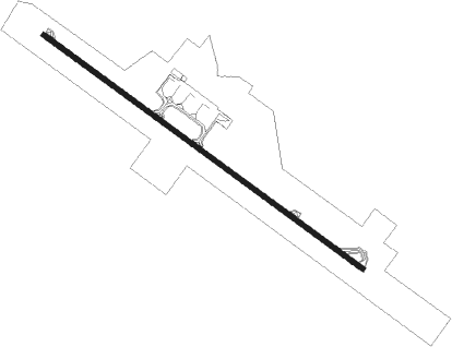
Banjul - Banjul Intl
Airport details
| Country | Gambia |
| State | West Coast Division |
| Region | GB |
| Airspace | Dakar Ctr |
| Municipality | Kombo North/Saint Mary |
| Elevation | 95ft (29m) |
| Timezone | GMT +0 |
| Coordinates | 13.34252, -16.65781 |
| Magnetic var | |
| Type | land |
| Available since | X-Plane v10.32 |
| ICAO code | GBYD |
| IATA code | BJL |
| FAA code | n/a |
Communication
| Banjul Intl GAMBIA AIRWAYS MULTICOM | 130.600 |
| Banjul Intl BANJUL Tower | 118.300 |
| Banjul Intl BANJUL TOWER Approach | 121.300 |
Approach frequencies
| ILS-cat-I | RW32 | 109.5 | 18.00mi |
| 3° GS | RW32 | 109.5 | 18.00mi |
Nearby Points of Interest:
Tanbi Wetland Complex
-Ruins of San Domingo
-Saloum Delta National Park
-Saloum Delta
Nearby beacons
| code | identifier | dist | bearing | frequency |
|---|---|---|---|---|
| BJ | BANJUL VOR/DME | 0.2 | 152° | 112.90 |
| ZG | ZIGUINCHOR VOR | 52.2 | 154° | 112.50 |
Instrument approach procedures
| runway | airway (heading) | route (dist, bearing) |
|---|---|---|
| RW14 | DENOS (130°) | DENOS 2500ft YD003 (5mi, 130°) 1600ft |
| RW14 | YD001 (155°) | YD001 2500ft YD003 (6mi, 201°) 1600ft |
| RW14 | YD002 (106°) | YD002 2500ft YD003 (6mi, 61°) 1600ft |
| RW14 | YD007 (214°) | YD007 2500ft YD001 (13mi, 275°) 2500ft YD003 (6mi, 201°) 1600ft |
| RNAV | YD003 1600ft YD004 (5mi, 130°) 1600ft GBYD (5mi, 130°) 138ft YD006 (3mi, 130°) (1272mi, 129°) YD007 (1276mi, 309°) 2500ft | |
| RW32 | AMTOL (310°) | AMTOL 2500ft YD010 (5mi, 311°) 1600ft |
| RW32 | YD008 (334°) | YD008 2500ft YD010 (6mi, 21°) 1600ft |
| RW32 | YD009 (287°) | YD009 2500ft YD010 (6mi, 242°) 1600ft |
| RW32 | YD014 (30°) | YD014 2500ft YD008 (13mi, 95°) 2500ft YD010 (6mi, 21°) 1600ft |
| RNAV | YD010 1600ft YD011 (5mi, 310°) 1600ft GBYD (6mi, 310°) 125ft YD013 (2mi, 310°) (1277mi, 129°) YD014 (1273mi, 308°) 2500ft |
Disclaimer
The information on this website is not for real aviation. Use this data with the X-Plane flight simulator only! Data taken with kind consent from X-Plane 12 source code and data files. Content is subject to change without notice.
