Clayton - Heavens Ldg
Airport details
| Country | United States of America |
| State | Georgia |
| Region | K7 |
| Airspace | Atlanta Ctr |
| Municipality | Rabun County |
| Elevation | 2724ft (830m) |
| Timezone | GMT -5 |
| Coordinates | 34.91418, -83.45943 |
| Magnetic var | |
| Type | land |
| Available since | X-Plane v10.40 |
| ICAO code | GE99 |
| IATA code | n/a |
| FAA code | GE99 |
Communication
Nearby Points of Interest:
Tallulah Falls School
-Long Creek Academy
-Towns County Jail
-Cabin Ben
-Baldwin-Coker Cottage
-Pendergrass Building
-Sautee Valley Historic District
-Franklin Presbyterian Church
-Saint Agnes Episcopal Church
-Albert Swain Bryson House
-Nikwasi
-Jacks Knob Trail
-Stumphouse Mountain Tunnel
-Henry Asbury House
-Mauldin House
-Spikebuck Town Mound and Village Site
-Arkaquah Trail
-Clay County Courthouse
-Jarrett-Hayes House
-James B. Simmons House
-Stephens County Courthouse
-Oconee County Courthouse
-Walhalla Graded School
-Zachery-Tolbert house
-Tamassee DAR School
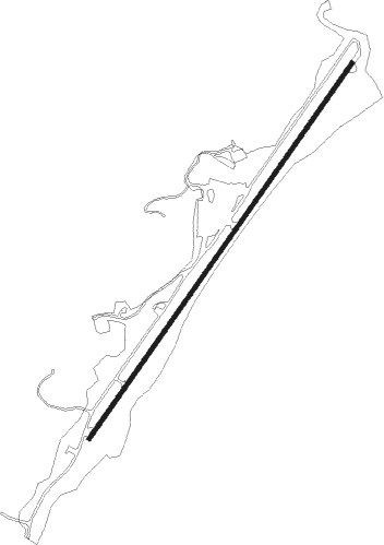
Runway info
| Runway 5 / 23 | ||
| length | 1544m (5066ft) | |
| bearing | 45° / 225° | |
| width | 15m (50ft) | |
| surface | concrete | |
Nearby beacons
| code | identifier | dist | bearing | frequency |
|---|---|---|---|---|
| ODF | FOOTHILLS (TOCCOA) VOR/DME | 15.3 | 143° | 113.40 |
| HRS | HARRIS VORTAC | 22.5 | 274° | 109.80 |
| ELW | ELECTRIC CITY (ANDERSON) VORTAC | 44.6 | 126° | 108.60 |
| FKV | FLOWERY BRANCH (GAINESVILLE) NDB | 48 | 212° | 365 |
| BRA | BROAD RIVER (ASHEVILLE) NDB | 53.1 | 70° | 379 |
| SOT | SNOWBIRD VORTAC | 56.2 | 25° | 108.80 |
| IM | KEANS (ASHEVILLE) NDB | 56.6 | 55° | 357 |
| TX | GWNET (LAWRENCEVILLE) NDB | 57.3 | 204° | 419 |
| AHN | ATHENS VOR/DME | 58.4 | 172° | 109.60 |
| BMW | BARROW COUNTY (WINDER) NDB | 59.1 | 188° | 404 |
| VXV | VOLUNTEER (KNOXVILLE) VORTAC | 63.1 | 336° | 116.40 |
Instrument approach procedures
| runway | airway (heading) | route (dist, bearing) |
|---|---|---|
| RW23 | DILLA (257°) | DILLA LENPY (3mi, 319°) 7000ft FAXIV (5mi, 304°) 7000ft |
| RW23 | HRS (94°) | HRS CIMTA (29mi, 71°) 7700ft FAXIV (5mi, 124°) 7000ft |
| RW23 | ODF (323°) | ODF FAXIV (23mi, 1°) 7100ft FAXIV (turn) 7000ft |
| RNAV | FAXIV 7000ft JAGEV (4mi, 225°) 5800ft HAKIV (2mi, 225°) 5100ft GE99 (7mi, 225°) 2775ft (5083mi, 113°) 3124ft DILLA (5069mi, 293°) 8000ft DILLA (turn) |
Disclaimer
The information on this website is not for real aviation. Use this data with the X-Plane flight simulator only! Data taken with kind consent from X-Plane 12 source code and data files. Content is subject to change without notice.