Ifrane
Airport details
| Country | Morocco |
| State | Ifrane Province |
| Region | GM |
| Airspace | Casablanca Ctr |
| Municipality | Ben Smim |
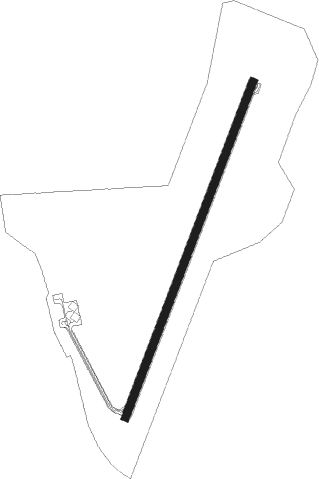
| Elevation | 5464ft (1665m) |
| Timezone | GMT +0 |
| Coordinates | 33.50555, -5.15250 |
| Magnetic var | |
| Type | land |
| Available since | X-Plane v10.40 |
| ICAO code | GMFI |
| IATA code | n/a |
| FAA code | n/a |
Communication
| Ifrane Ifrane Tour | 131.000 |
Nearby Points of Interest:
El Hajeb Kasbah
-Meknes Royal Military Academy
-Heri es-Souani
-Agdal Basin
-Dar Al Makhzen (Meknes)
-Mausoleum of Moulay Ismail
-Kara Prison
-Koubat Al Khayatine
-El Hedim Square
-Medina of Meknes
-Great Mosque of Meknes
-Bab Berdieyinne Mosque
-Bab Berdieyinne
Nearby beacons
| code | identifier | dist | bearing | frequency |
|---|---|---|---|---|
| IFN | IFRANE NDB | 0.5 | 235° | 409 |
| FES | FES VOR/DME | 26.2 | 18° | 115.70 |
| FEZ | SAISS (FES) NDB | 28.4 | 32° | 315 |
| MKS | MEKNES VOR | 28.9 | 316° | 116.30 |
| SMN | SIDI SLIMANE VOR/DME | 62.7 | 309° | 115.50 |
| CNV | TOUAHAR NDB | 63.9 | 54° | 270 |
Departure and arrival routes
| SID end points | distance | outbound heading | |
|---|---|---|---|
| RW03 | |||
| FES1N | 26mi | 18° | |
| BOKP1N | 60mi | 32° | |
| VAXA1N | 24mi | 344° | |
| DEMU1N | 27mi | 347° | |
| RW21 | |||
| FES1P | 26mi | 18° | |
| BOKP1P | 60mi | 32° | |
| VAXA1P | 24mi | 344° | |
| DEMU1P | 27mi | 347° | |
| STAR starting points | distance | inbound heading | |
|---|---|---|---|
| ALL | |||
| FES1L | 26.2 | 198° | |
| EMKO1L | 54.4 | 232° | |
Instrument approach procedures
| runway | airway (heading) | route (dist, bearing) |
|---|---|---|
| RW03 | FI400 (218°) | FI400 FI404 (6mi, 178°) 8500ft FI405 (13mi, 208°) 8100ft FI406 (11mi, 208°) 8100ft FI408 (6mi, 292°) 8100ft |
| RW03 | FI402 (237°) | FI402 FI404 (11mi, 244°) 8500ft FI405 (13mi, 208°) 8100ft FI406 (11mi, 208°) 8100ft FI408 (6mi, 292°) 8100ft |
| RW03 | FI405 (289°) | FI405 8100ft FI406 (11mi, 208°) 8100ft FI408 (6mi, 292°) 8100ft |
| RNAV | FI408 8100ft FI410 (5mi, 29°) 7000ft GMFI (5mi, 30°) 5515ft FI420 (6mi, 29°) FI405 (8mi, 155°) | |
| RW21 | FI400 (218°) | FI400 FI418 (8mi, 229°) 7100ft |
| RW21 | FI402 (237°) | FI402 FI404 (11mi, 244°) FI418 (6mi, 268°) 7100ft |
| RW21 | FI430 (254°) | FI430 8500ft FI416 (5mi, 28°) 7200ft FI418 (5mi, 292°) 7100ft |
| RNAV | FI418 7100ft FI420 (5mi, 210°) 7100ft GMFI (6mi, 209°) 5482ft FI410 (5mi, 210°) FI430 (12mi, 57°) |
Disclaimer
The information on this website is not for real aviation. Use this data with the X-Plane flight simulator only! Data taken with kind consent from X-Plane 12 source code and data files. Content is subject to change without notice.