Ben Slimane
Airport details
| Country | Morocco |
| State | Casablanca Province |
| Region | GM |
| Airspace | Casablanca Ctr |
| Municipality | Ain Tizgha عين تيزغة |
| Elevation | 625ft (190m) |
| Timezone | GMT +0 |
| Coordinates | 33.65432, -7.22572 |
| Magnetic var | |
| Type | land |
| Available since | X-Plane v10.40 |
| ICAO code | GMMB |
| IATA code | GMD |
| FAA code | n/a |
Communication
| Ben Slimane Tower | 118.200 |
| Ben Slimane Approach | 121.300 |
Nearby Points of Interest:
Casablanca
-Casablanca Cathedral
-Arab League Park of Casablanca
-Dar al-Makhzen
-M'hammed Guessous School
-Moulay Youssef College
-As-Sunna Mosque (Rabat)
-Rabat-City train station
-Agency for the development of the Bouregreg valley
-Borj Sirat
-Great Mosque of Rabat
-Borj Lalla Qadiya
-Borj Sidi Makhlouf
-Medina of Rabat
-Bab Dar Assinaa
-Bab Bouhaja
-Bab el-Mrissa
-Enclosure of the Medina of Salé
-Marinid Madrasa of Salé
-Madrasa Bou Inaniya (Salé)
-Medina of Salé
-Zawiya en-Noussak
-Borj El kébir
Runway info
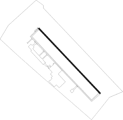
| Runway 14 / 32 | ||
| length | 3053m (10016ft) | |
| bearing | 136° / 316° | |
| width | 46m (150ft) | |
| surface | asphalt | |
| displ threshold | 0m (0ft) / 246m (807ft) | |
| blast zone | 76m (249ft) / 74m (243ft) | |
Nearby beacons
| code | identifier | dist | bearing | frequency |
|---|---|---|---|---|
| BNS | BENSLIMANE VOR/DME | 1.1 | 125° | 117.45 |
| CAE | BENSLIMANE NDB | 6 | 109° | 275 |
| NUA | NOUASSEUR (CASABLANCA) NDB | 23.4 | 240° | 255 |
| CBL | CASABLANCA VOR/DME | 23.6 | 238° | 115.10 |
| CBA | DME | 23.9 | 254° | 116.90 |
| SAK | ANFA NDB | 23.9 | 254° | 413 |
| NSR | BARRECHID (CASABLANCA) NDB | 28.2 | 221° | 282 |
| RBT | RABAT VOR/DME | 33.7 | 50° | 116.50 |
| SLK | SIDI KHEDIM (CASABLANCA) VOR/DME | 35.2 | 207° | 112.50 |
| SBI | RABAT NDB | 42 | 47° | 332 |
| CNL | KENITRA NDB | 48.5 | 44° | 380 |
| CSD | DAOURAT NDB | 60.4 | 229° | 345 |
Instrument approach procedures
| runway | airway (heading) | route (dist, bearing) |
|---|---|---|
| RW14 | BISMI (271°) | BISMI 3000ft MB501 (13mi, 293°) MB502 (10mi, 316°) MB503 (7mi, 237°) 3000ft |
| RW14 | BNS (305°) | BNS 3000ft MB501 (7mi, 37°) MB502 (10mi, 316°) MB503 (7mi, 237°) 3000ft |
| RW14 | MB507 (137°) | MB507 3000ft MB503 (5mi, 136°) 3000ft |
| RNAV | MB503 3000ft MB504 (4mi, 136°) 2500ft GMMB (7mi, 138°) 576ft MB506 (7mi, 134°) BNS (6mi, 316°) BNS (turn) 3000ft | |
| RW32 | BISMI (271°) | BISMI 3000ft MB510 (12mi, 237°) 3000ft |
| RW32 | MB645 (5°) | MB645 3000ft MB510 (10mi, 56°) 3000ft |
| RNAV | MB510 3000ft MB511 (4mi, 316°) 2500ft MB513 (3mi, 316°) 1500ft GMMB (3mi, 312°) 669ft MB512 (5mi, 319°) BNS (6mi, 136°) BNS (turn) 3000ft |
Disclaimer
The information on this website is not for real aviation. Use this data with the X-Plane flight simulator only! Data taken with kind consent from X-Plane 12 source code and data files. Content is subject to change without notice.