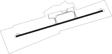
Nador - Nador El Aroui
Airport details
| Country | Morocco |
| State | Nador Province |
| Region | GM |
| Airspace | Casablanca Ctr |
| Municipality | Bni Oukil Oulad M'Hand |
| Elevation | 574ft (175m) |
| Timezone | GMT +0 |
| Coordinates | 34.98944, -3.02778 |
| Magnetic var | |
| Type | land |
| Available since | X-Plane v10.40 |
| ICAO code | GMMW |
| IATA code | NDR |
| FAA code | n/a |
Communication
| Nador El Aroui Tower | 136.200 |
| Nador El Aroui Tower | 118.650 |
Approach frequencies
| ILS-cat-I | RW08 | 108.7 | 18.00mi |
| 3.2° GS | RW08 | 108.7 | 18.00mi |
Nearby beacons
| code | identifier | dist | bearing | frequency |
|---|---|---|---|---|
| ARI | NADOR VOR/DME | 0.1 | 209° | 116 |
| MEL | MELILLA VOR/DME | 17.8 | 13° | 114.25 |
| MIA | MELILLA NDB | 19.4 | 13° | 292 |
| MLL | DME | 19.4 | 13° | 117.40 |
| ALM | AL HOCEIMA VOR/DME | 41.7 | 284° | 115 |
| ALU | AL HOCEIMA NDB | 41.7 | 283° | 401 |
| ALB | ALBORAN NDB | 56.9 | 360° | 519 |
Instrument approach procedures
| runway | airway (heading) | route (dist, bearing) |
|---|---|---|
| RW08 | MW085 (104°) | MW085 5000ft MW083 (8mi, 165°) 4100ft |
| RW08 | MW087 (62°) | MW087 4800ft MW083 (6mi, 346°) 4100ft |
| RW08 | SOBGO (347°) | SOBGO 5000ft MW087 (15mi, 261°) 4800ft MW083 (6mi, 346°) 4100ft |
| RNAV | MW083 4100ft MW081 (5mi, 80°) 3600ft GMMW (10mi, 80°) 650ft MW264 (12mi, 80°) 2800ft SOBGO (14mi, 238°) 5000ft SOBGO (turn) 5000ft | |
| RW26 | MW266 (282°) | MW266 3600ft MW264 (6mi, 346°) 3600ft |
| RW26 | SOBGO (347°) | SOBGO 5000ft MW266 (13mi, 80°) 3600ft MW264 (6mi, 346°) 3600ft |
| RNAV | MW264 3600ft MW262 (5mi, 260°) 2700ft GMMW (7mi, 260°) 621ft MW568 (8mi, 271°) 2100ft ARI (8mi, 92°) 4800ft SOBGO (6mi, 166°) 5000ft SOBGO (turn) 5000ft |
Disclaimer
The information on this website is not for real aviation. Use this data with the X-Plane flight simulator only! Data taken with kind consent from X-Plane 12 source code and data files. Content is subject to change without notice.
